|
|
Weather Alert |
| Summit County, OH | |||||||||
|
|
||||||||
|
Canceled 11/27/25 2:53 PM Winter Weather Advisory issued November 27 at 2:06PM EST until November 28 at 7:00PM EST by NWS Cleveland OH * WHAT... Lake effect snow occurring. Additional snow accumulations of 3 to 6 inches in northern Summit County, northern Portage County, and northern and central Trumbull County. Amounts will decrease farther south across the area. Winds gusting as high as 35 mph. * WHERE... Summit, Portage and Trumbull counties. * WHEN... Until 7 PM EST Friday. * IMPACTS... Travel could be very difficult due to periods of snow covered roads and reduced visibility in lake effect snow. * ADDITIONAL DETAILS... The heaviest snow is expected tonight into early Friday as snow bands sag south into the area from the north. Snowfall rates will likely reach 1 inch per hour at times within bands tonight. Locally higher totals are possible in northern Portage and Trumbull Counties, and a Lake Effect Snow Warning may be needed if these become more likely. 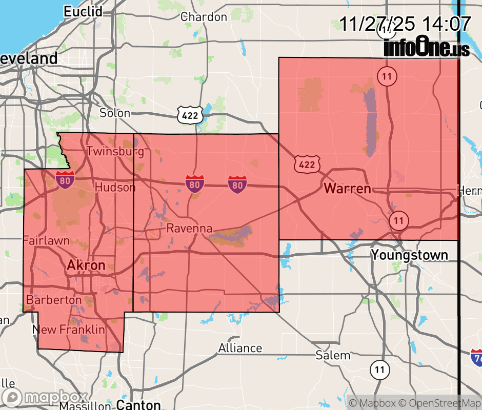 |
|||||||||
 Why aren't you using the InfoOne app? Why aren't you using the InfoOne app?
Stay abreast of information affecting your community! InfoOne tracks real-time information such as:
InfoOne currently supports over 100 communities in NC, VA and WV, and our coverage area is steadily growing. It's free! Install the InfoOne app today and see what you've been missing. |
|||||||||