|
|
Weather Alert |
| Summit County, OH | |||||||||
|
|
||||||||
|
Canceled 5/14/22 7:20 PM Severe Thunderstorm Warning issued May 14 at 6:49PM EDT until May 14 at 7:45PM EDT by NWS Cleveland OH The National Weather Service in Cleveland has issued a * Severe Thunderstorm Warning for... Central Stark County in northeastern Ohio... Southeastern Summit County in northeastern Ohio... * Until 745 PM EDT. * At 649 PM EDT, a severe thunderstorm was located over North Canton, or near Canton, moving south at 5 mph. HAZARD...60 mph wind gusts and quarter size hail. SOURCE...Radar indicated. IMPACT...Minor damage to vehicles is possible. Expect damage to trees and power lines. * Locations impacted include... Canton, Massillon, Green, North Canton, Louisville, Hartville, Meyers Lake, Hills And Dales, Greentown and Perry Heights. 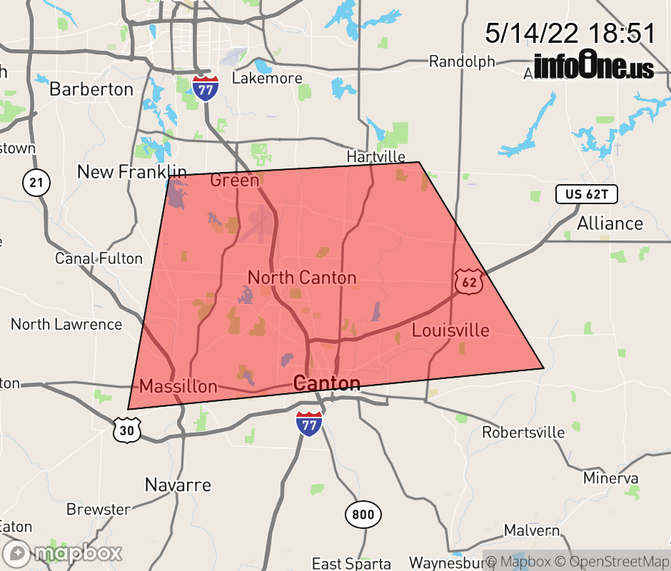 |
|||||||||
 Why aren't you using the InfoOne app? Why aren't you using the InfoOne app?
Stay abreast of information affecting your community! InfoOne tracks real-time information such as:
InfoOne currently supports over 100 communities in NC, VA and WV, and our coverage area is steadily growing. It's free! Install the InfoOne app today and see what you've been missing. |
|||||||||