|
|
Weather Alert |
| Mineral County, WV | |||||||||
|
|
||||||||
|
Canceled 5/13/25 6:09 PM Flash Flood Warning issued May 13 at 1:03PM EDT until May 13 at 6:45PM EDT by NWS Baltimore MD/Washington DC At 103 PM EDT, Doppler radar indicated thunderstorms producing heavy rain across the warned area. Between 2 and 3.5 inches of rain have fallen. The expected rainfall rate is 0.5 to 1.5 inches in 1 hour. Additional rainfall amounts of 0.5 to 1.5 inches are possible in the warned area. Flash flooding is already occurring. HAZARD...Life threatening flash flooding. Thunderstorms producing flash flooding. SOURCE...Radar. IMPACT...Life threatening flash flooding of creeks and streams, urban areas, highways, streets and underpasses. Some locations that will experience flash flooding include... Cumberland... Frostburg... Keyser... Bel Air... La Vale... Fort Ashby... Lonaconing... Ridgeley... Cresaptown... Potomac Park... Wiley Ford... Eckhart Mines... Mount Savage... Rawlings... Ellerslie... Corriganville... Midland... Midlothian... Woodland... Spring Gap... 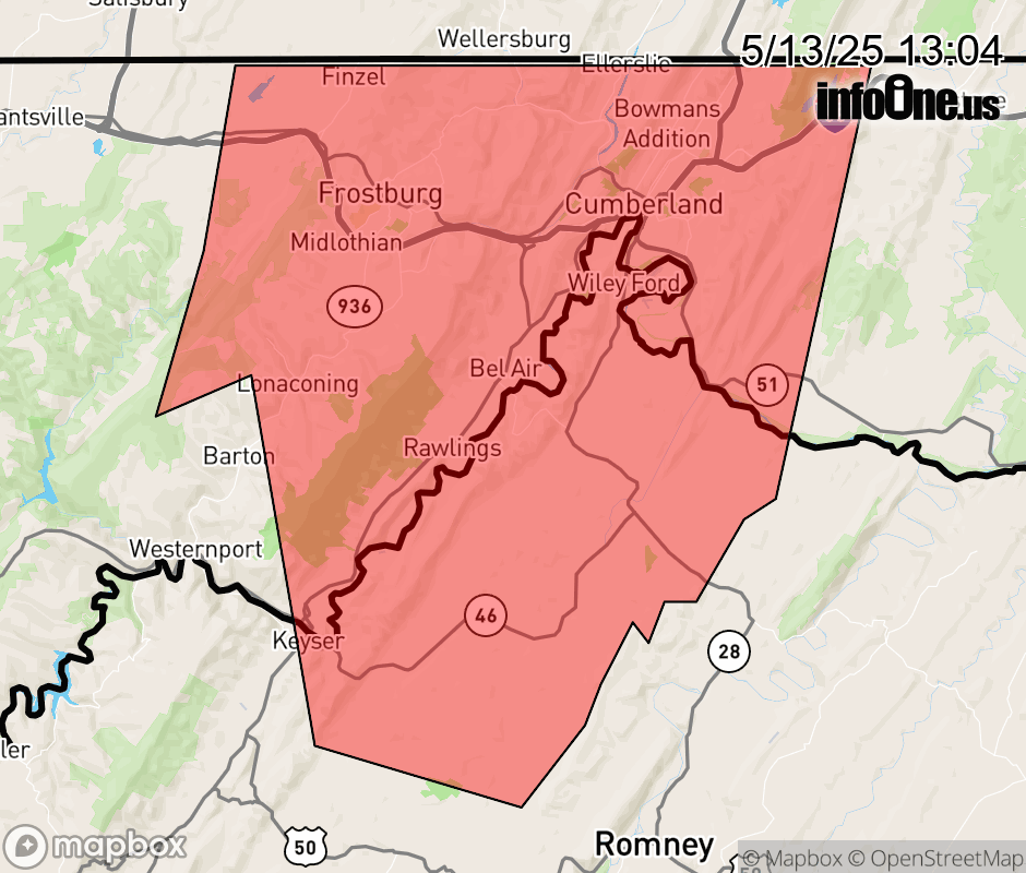 |
|||||||||
 Why aren't you using the InfoOne app? Why aren't you using the InfoOne app?
Stay abreast of information affecting your community! InfoOne tracks real-time information such as:
InfoOne currently supports over 100 communities in NC, VA and WV, and our coverage area is steadily growing. It's free! Install the InfoOne app today and see what you've been missing. |
|||||||||