|
|
Weather Alert |
| Monroe County, OH | |||||||||
|
|
||||||||
|
Canceled 6/6/26 9:49 PM Severe Thunderstorm Warning issued June 6 at 9:34PM EDT until June 6 at 10:15PM EDT by NWS Pittsburgh PA SVRPBZ The National Weather Service in Pittsburgh has issued a * Severe Thunderstorm Warning for... Eastern Monroe County in east central Ohio... Marshall County in northern West Virginia... Northwestern Wetzel County in northern West Virginia... * Until 1015 PM EDT. * At 934 PM EDT, a severe thunderstorm was located near Woodsfield, moving southeast at 35 mph. HAZARD...60 mph wind gusts and quarter size hail. SOURCE...Radar indicated. IMPACT...Hail damage to vehicles is expected. Expect wind damage to roofs, siding, and trees. * Locations impacted include... New Martinsville, Woodsfield, Pine Grove, Sardis, Beallsville, Clarington, Jerusalem, Wilson, Cameron, Miltonsburg, Proctor, Hannibal, Woodlands, Porters Falls, Laings, Lynn Camp, Reader and Wileyville. 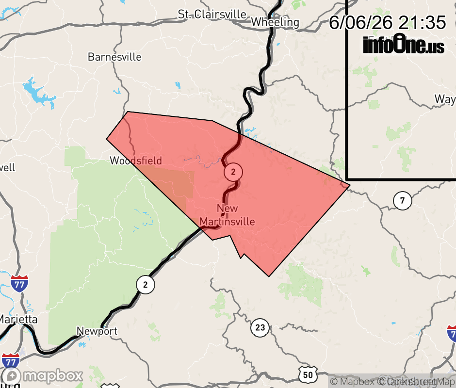 |
|||||||||
 Why aren't you using the InfoOne app? Why aren't you using the InfoOne app?
Stay abreast of information affecting your community! InfoOne tracks real-time information such as:
InfoOne currently supports over 100 communities in NC, VA and WV, and our coverage area is steadily growing. It's free! Install the InfoOne app today and see what you've been missing. |
|||||||||