|
|
Weather Alert |
| Scott County, VA | |||||||||
|
|
||||||||
|
Canceled 9/27/23 5:15 PM Special Weather Statement issued September 27 at 4:35PM EDT by NWS Morristown TN At 435 PM EDT, Doppler radar was tracking a strong thunderstorm near Sneedville, moving east at 20 mph. HAZARD...Wind gusts up to 40 mph and pea size hail. SOURCE...Radar indicated. IMPACT...Gusty winds could knock down tree limbs and blow around unsecured objects. Minor hail damage to vegetation is possible. Locations impacted include... Rogersville, Sneedville, Surgoinsville, Church Hill, Clinchport, Okolona, Kepler, Kyles Ford, and Klondike. 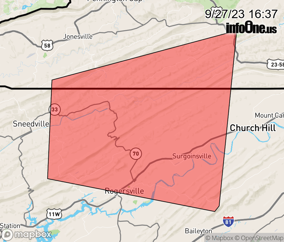 |
|||||||||
 Why aren't you using the InfoOne app? Why aren't you using the InfoOne app?
Stay abreast of information affecting your community! InfoOne tracks real-time information such as:
InfoOne currently supports over 100 communities in NC, VA and WV, and our coverage area is steadily growing. It's free! Install the InfoOne app today and see what you've been missing. |
|||||||||