
|
Weather Alert |
| Watauga County, NC | |||||||||
|
|
||||||||
|
Canceled 10/11/26 2:53 PM Flood Advisory issued October 11 at 12:47PM EDT until October 11 at 3:00PM EDT by NWS Blacksburg VA * WHAT... Flooding caused by excessive rainfall continues. * WHERE... Ashe County in northwestern North Carolina... Watauga County in northwestern North Carolina... * WHEN... Until 300 PM EDT. * IMPACTS... Flooding in low-lying and poor drainage areas. Strong flows over low-water crossings will continue through the middle of the afternoon, especially those along the Watauga River in western Watauga County. Most river levels continue to recede this afternoon, however water remains over a few roadways, including Todd Railroad Grade Road along the South Fork of the New River. * ADDITIONAL DETAILS... - At 1243 PM EDT, Doppler radar and automated rain gauges indicated that rain has exited the advisory area. However, minor flooding continues due to between 4 and 7 inches of rain that fell from Saturday morning through this morning. - This includes the following streams and drainages... Big Laurel Creek, Beaver Creek, Beech Creek, Big Horse Creek, Cove Creek, Call Creek, Beaverdam Creek and Brushy Fork. - Some locations that will experience flooding include... Jefferson, West Jefferson, Beech Mountain, Lansing, Ashland, Glendale Springs and Sugar Grove. - For flooding safety information, please visit http://www.weather.gov/safety/flood 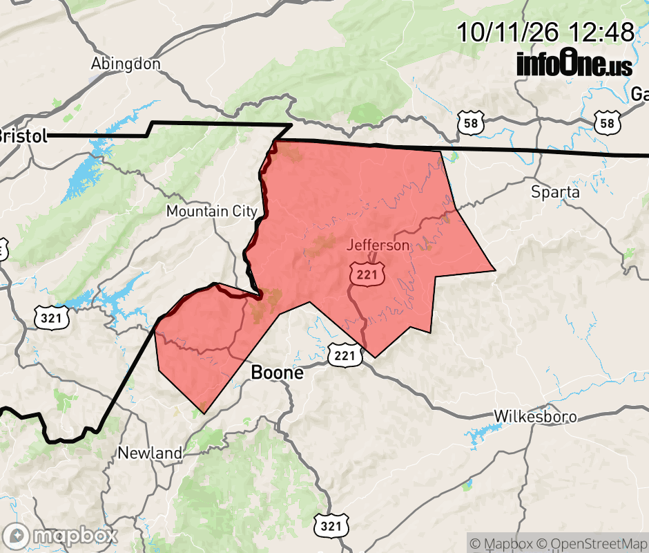 |
|||||||||
 Why aren't you using the InfoOne app? Why aren't you using the InfoOne app?
Stay abreast of information affecting your community! InfoOne tracks real-time information such as:
InfoOne currently supports over 100 communities in NC, VA and WV, and our coverage area is steadily growing. It's free! Install the InfoOne app today and see what you've been missing. |
|||||||||