|
|
Weather Alert |
| Rowan County, NC | |||||||||
|
|
||||||||
|
Canceled 3/5/25 9:00 AM Severe Thunderstorm Warning issued March 5 at 8:46AM EST until March 5 at 9:00AM EST by NWS Greenville-Spartanburg SC At 846 AM EST, severe thunderstorms were located along a line extending from 4 miles southwest of Downtown Concord to 9 miles west of Monroe, moving northeast at 45 mph. HAZARD...60 mph wind gusts. SOURCE...Radar indicated. IMPACT...Expect damage to trees and power lines. Locations impacted include... Marshville, Mt Pleasant, Trinity, Gold Hill, Monroe, Rockwell, Wingate, Midland, New Salem, and High Rock. 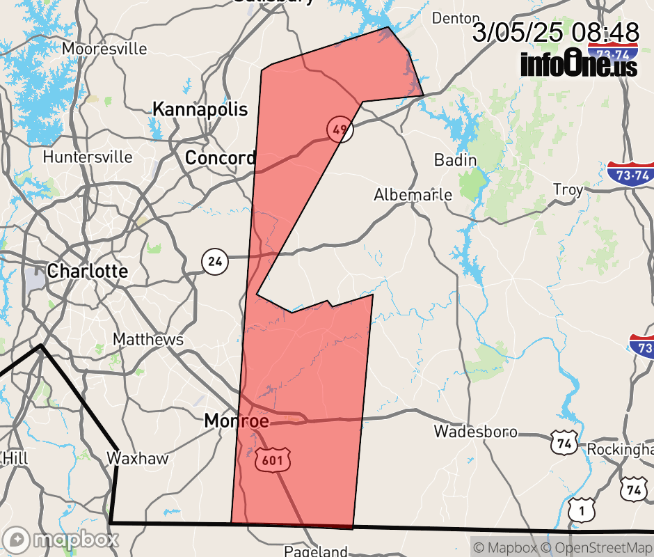 |
|||||||||
 Why aren't you using the InfoOne app? Why aren't you using the InfoOne app?
Stay abreast of information affecting your community! InfoOne tracks real-time information such as:
InfoOne currently supports over 100 communities in NC, VA and WV, and our coverage area is steadily growing. It's free! Install the InfoOne app today and see what you've been missing. |
|||||||||