|
|
Weather Alert |
| Monroe County, OH | |||||||||
|
|
||||||||
|
Canceled 6/13/21 3:06 PM Severe Thunderstorm Warning issued June 13 at 2:55PM EDT until June 13 at 3:15PM EDT by NWS Pittsburgh PA At 255 PM EDT, a severe thunderstorm was located over Pine Grove, or 8 miles southeast of New Martinsville, moving southeast at 25 mph. HAZARD...Wind gusts to 60 mph and quarter-size hail. SOURCE...Radar. IMPACT...Minor hail damage to vehicles is possible. Expect wind damage to trees and power lines, resulting in some power outages. Locations impacted include... New Martinsville... Pine Grove... Jacksonburg... Smithfield... Porters Falls... Wileyville... Big Run... Reader... Folsom... 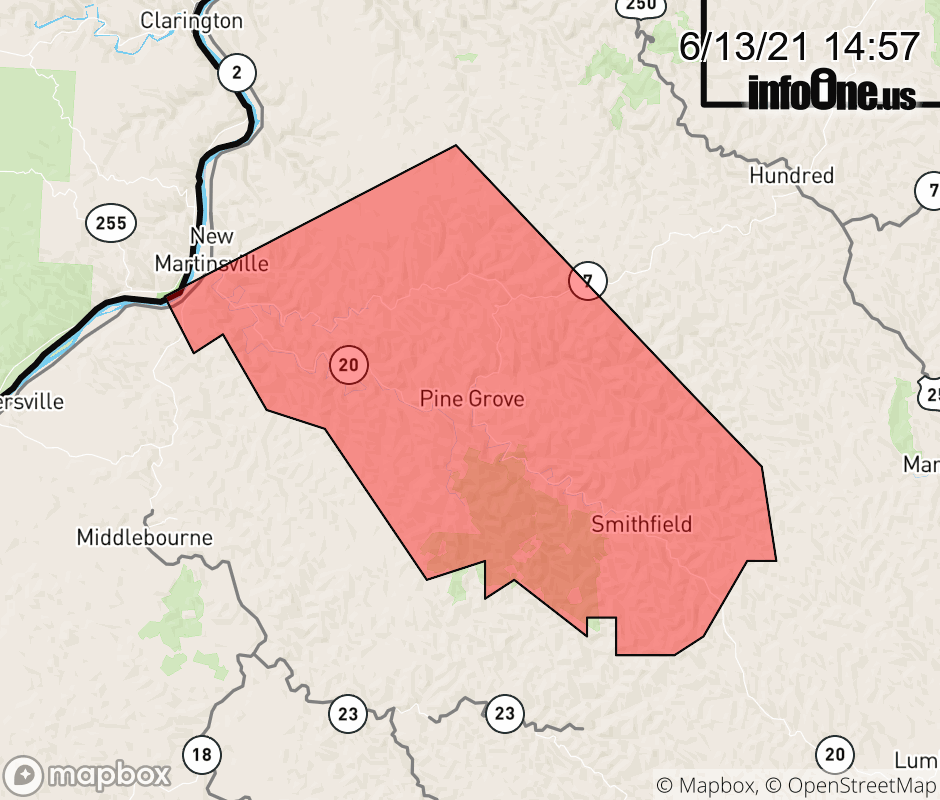 |
|||||||||
 Why aren't you using the InfoOne app? Why aren't you using the InfoOne app?
Stay abreast of information affecting your community! InfoOne tracks real-time information such as:
InfoOne currently supports over 100 communities in NC, VA and WV, and our coverage area is steadily growing. It's free! Install the InfoOne app today and see what you've been missing. |
|||||||||