|
|
Weather Alert |
| Raleigh County, WV | |||||||||
|
|
||||||||
|
Canceled 6/13/21 7:27 PM Severe Thunderstorm Warning issued June 13 at 7:12PM EDT until June 13 at 7:30PM EDT by NWS Charleston WV At 711 PM EDT, severe thunderstorms were located along a line extending from near Marlinton to near Richwood to near Hawks Nest State Park, moving east at 25 mph. HAZARD...60 mph wind gusts and quarter size hail. SOURCE...Radar indicated. IMPACT...Hail damage to vehicles is expected. Expect wind damage to roofs, siding, and trees. Locations impacted include... Summersville, Fayetteville, Richwood, Marlinton, Babcock State Park, Oak Hill, Mount Hope, Ansted, Gauley Bridge, Bradley, Craigsville, Hawks Nest State Park, Piney View, Prosperity, Powellton, Hillsboro, Thurmond, Canvas, Cranberry Mountain Nature Center and Swiss. 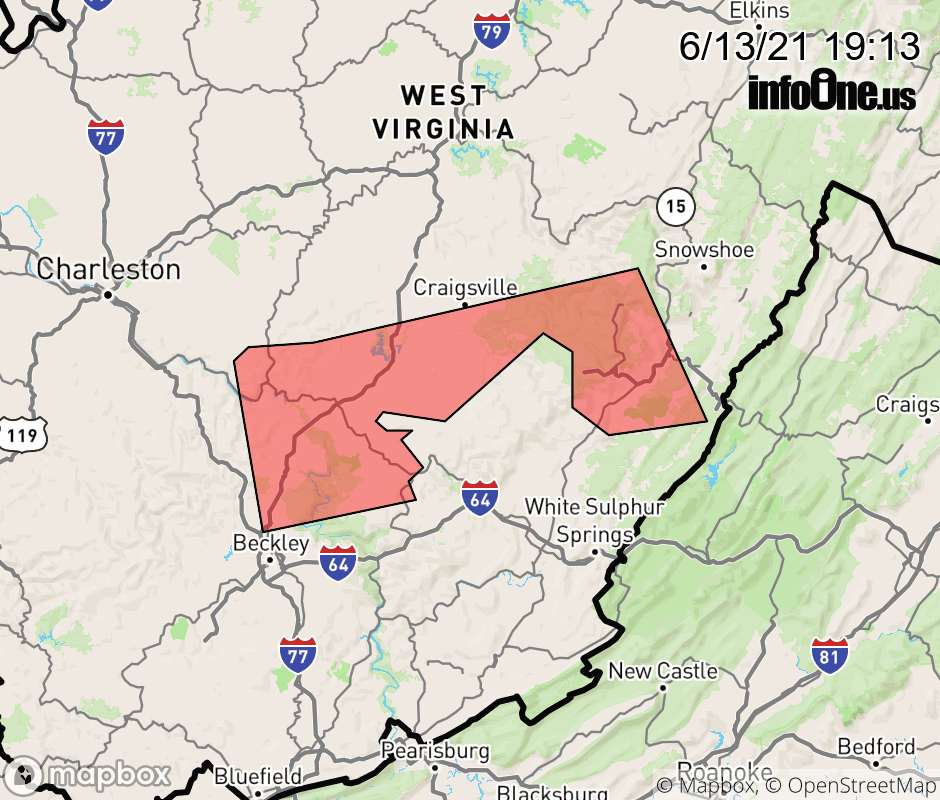 |
|||||||||
 Why aren't you using the InfoOne app? Why aren't you using the InfoOne app?
Stay abreast of information affecting your community! InfoOne tracks real-time information such as:
InfoOne currently supports over 100 communities in NC, VA and WV, and our coverage area is steadily growing. It's free! Install the InfoOne app today and see what you've been missing. |
|||||||||