
|
Weather Alert |
| Lawrence County, OH | |||||||||
|
|
||||||||
|
Canceled 8/11/26 5:15 PM Severe Thunderstorm Warning issued August 11 at 4:45PM EDT until August 11 at 5:15PM EDT by NWS Charleston WV SVRRLX The National Weather Service in Charleston West Virginia has issued a * Severe Thunderstorm Warning for... Northern Boyd County in northeastern Kentucky... Greenup County in northeastern Kentucky... Carter County in northeastern Kentucky... Southwestern Gallia County in southeastern Ohio... Southern Jackson County in southeastern Ohio... Lawrence County in southeastern Ohio... * Until 515 PM EDT. * At 445 PM EDT, severe thunderstorms were located along a line extending from near Pike Lake to 6 miles east of West Union to near Lewisburg, moving east at 50 mph. HAZARD...70 mph wind gusts. SOURCE...Radar indicated. IMPACT...Expect considerable tree damage. Damage is likely to mobile homes, roofs, and outbuildings. * Locations impacted include... Ashland, Ironton, Grayson, Coal Grove, Olive Hill, Oak Hill, Rio Grande, Cannonsburg, Lake Vesuvius, Grayson Lake State Park, Carter Caves State Park, Greenup, Coalton, Denton, Gesling, Greenbo Lake, Oldtown, Load, Letitia, and Princess. This includes Interstate 64 in Kentucky between mile markers 149 and 184. 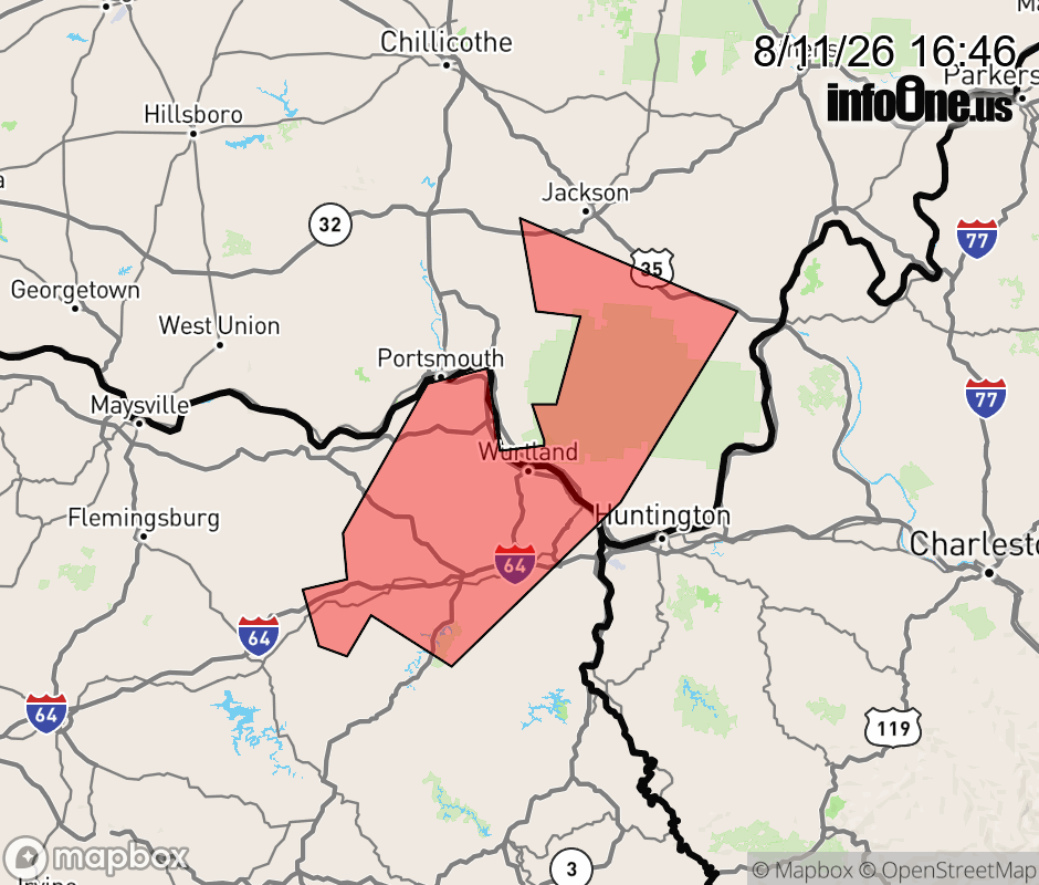 |
|||||||||
 Why aren't you using the InfoOne app? Why aren't you using the InfoOne app?
Stay abreast of information affecting your community! InfoOne tracks real-time information such as:
InfoOne currently supports over 100 communities in NC, VA and WV, and our coverage area is steadily growing. It's free! Install the InfoOne app today and see what you've been missing. |
|||||||||