|
|
Weather Alert |
| Franklin County, VA | |||||||||
|
|
||||||||
|
Canceled 6/8/21 1:45 PM Special Weather Statement issued June 8 at 1:01PM EDT by NWS Blacksburg VA At 1259 PM EDT, radar indicated strong thunderstorms were located along a line extending from Eagle Rock to Thaxton to near Rocky Mount. Movement was southeast at 10 mph. Locations impacted include... Bedford... Rocky Mount... Buchanan... Stewartsville... Moneta... Penhook... and Montvale. Locally heavy rain will quickly reduce visibility and result in ponding of water on roadways, standing water in low lying areas, and minor flooding of creeks, streams, and areas of poor drainage. Drivers are urged to slow down and use extra caution to avoid hydroplaning. This includes Interstate 81 especially between mile markers 160 and 180. Frequent cloud to ground lightning is occurring with these storms. Lightning can strike 10 miles away from a thunderstorm. Seek a safe shelter inside a building or vehicle. 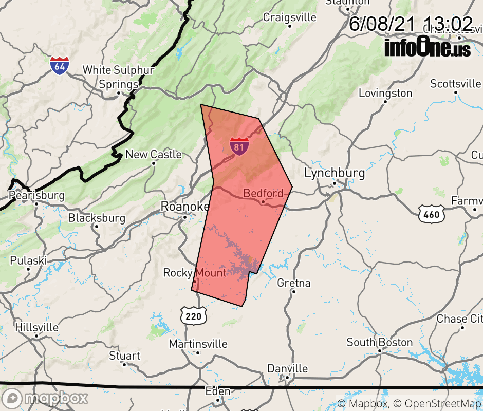 |
|||||||||
 Why aren't you using the InfoOne app? Why aren't you using the InfoOne app?
Stay abreast of information affecting your community! InfoOne tracks real-time information such as:
InfoOne currently supports over 100 communities in NC, VA and WV, and our coverage area is steadily growing. It's free! Install the InfoOne app today and see what you've been missing. |
|||||||||