|
|
Weather Alert |
| McDowell County, NC | |||||||||
|
|
||||||||
|
Canceled 5/12/25 3:15 PM Flood Watch issued May 12 at 11:48AM EDT until May 13 at 8:00AM EDT by NWS Greenville-Spartanburg SC * WHAT... Flash flooding caused by excessive rainfall continues to be possible. * WHERE... Portions of North Carolina, including the following counties, Alexander, Avery, Burke, Caldwell, McDowell, Polk, Rutherford, Henderson, Mitchell, Transylvania, and Yancey, plus the southern portion of Jackson County. Also, a portion of upstate South Carolina, namely the mountainous parts of Greenville and Pickens Counties. * WHEN... Through Tuesday morning. * IMPACTS... Excessive runoff may result in flooding of rivers, creeks, streams, and other low-lying and flood-prone locations. * ADDITIONAL DETAILS... - A slow-moving storm system is expected to bring multiple rounds of showers and storms today through tonight. Runoff from the moderate to heavy rainfall will likely cause flooding. The heaviest rainfall and greatest risk for flash flooding is expected along the Blue Ridge Escarpment and the southern and eastern-facing slopes of the mountains in western North Carolina. Rainfall totals of 3 to 5 inches with isolated amounts between 4 and 6 inches are possible in these areas. This will not be anywhere near the magnitude of flooding that occurred during Helene. - http://www.weather.gov/safety/flood 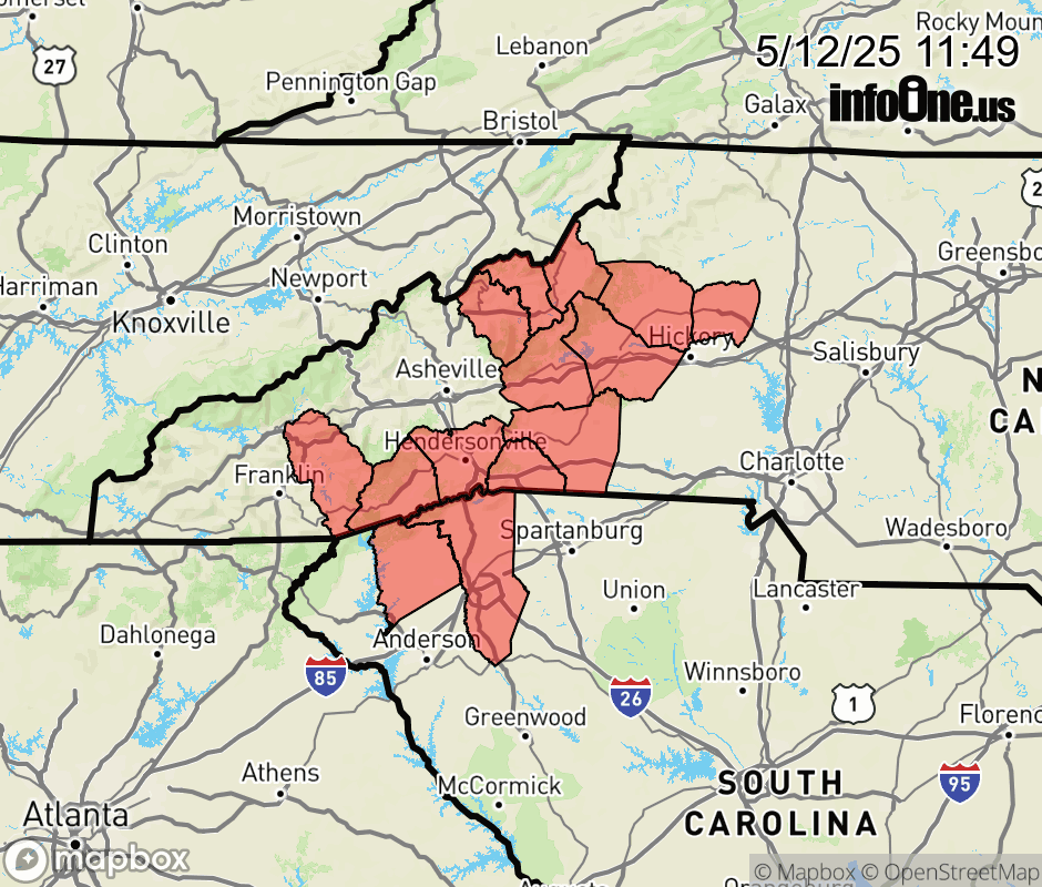 |
|||||||||
 Why aren't you using the InfoOne app? Why aren't you using the InfoOne app?
Stay abreast of information affecting your community! InfoOne tracks real-time information such as:
InfoOne currently supports over 100 communities in NC, VA and WV, and our coverage area is steadily growing. It's free! Install the InfoOne app today and see what you've been missing. |
|||||||||