|
|
Weather Alert |
| Berkeley County, WV | |||||||||
|
|
||||||||
|
Canceled 5/14/25 10:46 AM Flood Warning issued May 14 at 4:35AM EDT until May 16 at 5:00PM EDT by NWS Baltimore MD/Washington DC ...The Flood Warning is extended for the following rivers in West Virginia...Maryland... North Branch Potomac River Near Cumberland affecting Allegany, Hampshire and Mineral Counties. Opequon Creek near Martinsburg affecting Jefferson and Berkeley Counties. Cacapon River near Great Cacapon affecting Morgan County. ...The Flood Warning continues for the following rivers in West Virginia...Maryland...Virginia... Potomac River at Paw Paw affecting Morgan, Allegany and Hampshire Counties. Potomac River at Shepherdstown affecting Jefferson, Berkeley and Washington Counties. Rapidan River Near Culpeper affecting Orange, Culpeper and Spotsylvania Counties. Wills Creek near Cumberland affecting Allegany County. ...The Flood Warning is cancelled for the following rivers in West Virginia...Maryland... Potomac River at Hancock affecting Morgan and Washington Counties. Georges Creek at Westernport affecting Allegany County. For the North Branch Potomac River...including Kitzmiller, Luke, Cumberland...Minor flooding is forecast. For the Potomac River...including Paw Paw, Hancock, Shepherdstown, Harpers Ferry, Point of Rocks, Edwards Ferry, Little Falls... Moderate flooding is forecast. For the Rapidan River...including Culpeper...Minor flooding is forecast. For the Wills Creek...including Cumberland...Minor flooding is forecast. For the Opequon Creek...including Martinsburg...Minor flooding is forecast. For the Cacapon River...including Great Cacapon...Minor flooding is forecast. * WHAT... Minor flooding is forecast. * WHERE... Potomac River at Shepherdstown. * WHEN... From this afternoon to Friday afternoon. * IMPACTS... At 13.0 feet, River Road near Shepherdstown begins to flood. Water completely covers the boat ramp at Shepherdstown. At 15.0 feet, River Road is completely flooded in low spots between Shepherdstown and Harpers Ferry. Significant portions of the C&O Canal towpath are flooded between McMahons Mill and Dam Number Four. At 22.0 feet, Water approaches homes on the West Virginia side of the river near Shepherdstown, and impacts are also observed on the Maryland side, not just to the C&O Canal towpath, but also to roads and structures. * ADDITIONAL DETAILS... - At 3:30 AM EDT Wednesday the stage was 4.7 feet, or 10.3 feet below flood stage. - Forecast...The river will rise above flood stage late this afternoon to 21.4 feet just after midnight tonight. It will then fall tomorrow morning. It will rise to 20.7 feet early tomorrow afternoon. It will then fall below flood stage late Friday morning. - Flood stage is 15.0 feet. - Flood History...This crest compares to a previous crest of 21.4 feet on 12/31/1942. - Please visit www.weather.gov/safety/flood for flood safety and preparedness information 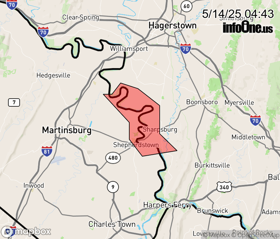 |
|||||||||
 Why aren't you using the InfoOne app? Why aren't you using the InfoOne app?
Stay abreast of information affecting your community! InfoOne tracks real-time information such as:
InfoOne currently supports over 100 communities in NC, VA and WV, and our coverage area is steadily growing. It's free! Install the InfoOne app today and see what you've been missing. |
|||||||||