|
|
Weather Alert |
| Jefferson County, WV | |||||||||
|
|
||||||||
|
Canceled 5/15/25 9:56 PM Flood Warning issued May 15 at 4:13PM EDT until May 16 at 8:32PM EDT by NWS Baltimore MD/Washington DC ...The Flood Warning continues for the following rivers in Maryland...West Virginia... Potomac River at Shepherdstown affecting Berkeley, Jefferson and Washington Counties. For the Potomac River...including Paw Paw, Hancock, Shepherdstown, Harpers Ferry, Point of Rocks, Edwards Ferry, Little Falls... Moderate flooding is forecast. * WHAT... Moderate flooding is occurring and minor flooding is forecast. * WHERE... Potomac River at Shepherdstown. * WHEN... Until tomorrow evening. * IMPACTS... At 22.0 feet, Water approaches homes on the West Virginia side of the river near Shepherdstown, and impacts are also observed on the Maryland side, not just to the C&O Canal towpath, but also to roads and structures. * ADDITIONAL DETAILS... - At 3:45 PM EDT Thursday the stage was 22.7 feet, or 7.7 feet above flood stage. - Recent Activity...The maximum river stage in the 24 hours ending at 3:45 PM EDT Thursday was 23.2 feet. - Forecast...The river is expected to fall below flood stage early tomorrow afternoon and continue falling to 12.4 feet Sunday morning. - Flood stage is 15.0 feet. - Flood History...This crest compares to a previous crest of 22.5 feet on 03/08/1967. - Please visit www.weather.gov/safety/flood for flood safety and preparedness information 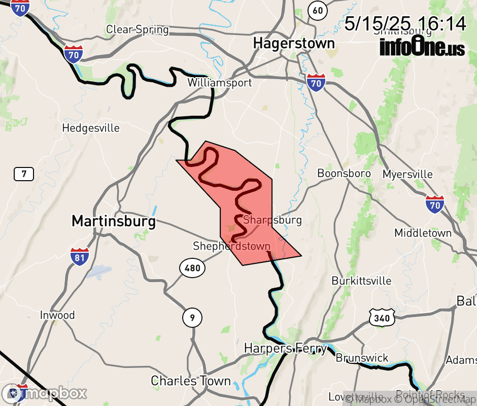 |
|||||||||
 Why aren't you using the InfoOne app? Why aren't you using the InfoOne app?
Stay abreast of information affecting your community! InfoOne tracks real-time information such as:
InfoOne currently supports over 100 communities in NC, VA and WV, and our coverage area is steadily growing. It's free! Install the InfoOne app today and see what you've been missing. |
|||||||||