|
|
Weather Alert |
| McDowell County, WV | |||||||||
|
|
||||||||
|
Canceled 5/8/25 8:23 PM Severe Thunderstorm Warning issued May 8 at 8:04PM EDT until May 8 at 8:30PM EDT by NWS Charleston WV SVRRLX The National Weather Service in Charleston West Virginia has issued a * Severe Thunderstorm Warning for... North central Buchanan County in southwestern Virginia... Northwestern McDowell County in southern West Virginia... Mingo County in southern West Virginia... Southwestern Logan County in southern West Virginia... * Until 830 PM EDT. * At 803 PM EDT, severe thunderstorms were located along a line extending from near Chattaroy to near Delbarton to near Mcandrews, moving east at 30 mph. HAZARD...60 mph wind gusts and quarter size hail. SOURCE...Radar indicated. IMPACT...Hail damage to vehicles is expected. Expect wind damage to roofs, siding, and trees. * Locations impacted include... Williamson, Man, Delbarton, R.d. Bailey Lake, Gilbert Creek, Red Jacket, Chattaroy, Hinch, Holden, Mallory, Matewan, Gilbert, Chauncey, Myrtle, Bruno, Edgarton, Hurley, Sarah Ann, Meador, and Panther. This includes Route 119 between mile markers 1 and 18. 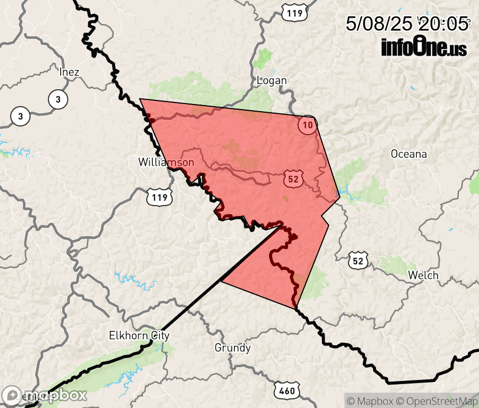 |
|||||||||
 Why aren't you using the InfoOne app? Why aren't you using the InfoOne app?
Stay abreast of information affecting your community! InfoOne tracks real-time information such as:
InfoOne currently supports over 100 communities in NC, VA and WV, and our coverage area is steadily growing. It's free! Install the InfoOne app today and see what you've been missing. |
|||||||||