|
|
Weather Alert |
| Scott County, VA | |||||||||
|
|
||||||||
|
Canceled 2/1/25 8:11 AM Flood Warning issued February 1 at 5:36AM EST until February 2 at 3:09AM EST by NWS Morristown TN ...The Flood Warning continues for the following rivers in Virginia...Tennessee... Clinch River Near Speers Ferry VA affecting Hancock and Scott Counties. Clinch River Above Tazewell TN affecting Grainger, Hancock and Claiborne Counties. Clinch River At Cleveland VA affecting Russell, Wise and Scott Counties. For the Clinch River...including Cleveland VA, Speers Ferry VA, Tazewell TN, NORRIS DAM TAILWATER, NORRIS DAM RESERVOIR, MELTON HILL DAM TAILWATER, MELTON HILL DAM RESERVOIR...Minor flooding is forecast. * WHAT... Minor flooding is occurring and minor flooding is forecast. * WHERE... Clinch River near Speers Ferry VA. * WHEN... Until late tonight. * IMPACTS... At 14.0 feet, Copper Creek Road at the Rexrena Access floods. At 18.0 feet, Low spots along Waters Edge Road flood. Most structures along Waters Edge Road are opposite the river and uphill from the road. At 18.5 feet, Bridge Street floods off of Clinch River Hwy near the suspension foot bridge. The grassy lot portion of an RV campground 0.8 miles upstream from the Clinchport Boat Ramp floods. At 19.5 feet, The gravel lot portion of an RV campground 0.8 miles upstream from the Clinchport Boat Ramp floods. At 21.0 feet, Additional flooding on Waters Edge Road. Low spots on Anglers Way Rd flood. One or two houses are threatened. Most riverside dwellings along Anglers Way Road are in the flood plain, lower than the road, but are mobile such as campers or fifth-wheelers. The parking lot of the Clinchport Boat Ramp off of Clinch River Hwy floods. * ADDITIONAL DETAILS... - At 5:15 AM EST Saturday the stage was 18.3 feet. - Bankfull stage is 18.0 feet. - Recent Activity...The maximum river stage in the 24 hours ending at 5:15 AM EST Saturday was 18.3 feet. - Forecast...The river is expected to rise to a crest of 19.5 feet this afternoon. It will then fall below flood stage late this evening. - Flood stage is 18.0 feet. - http://www.weather.gov/safety/flood 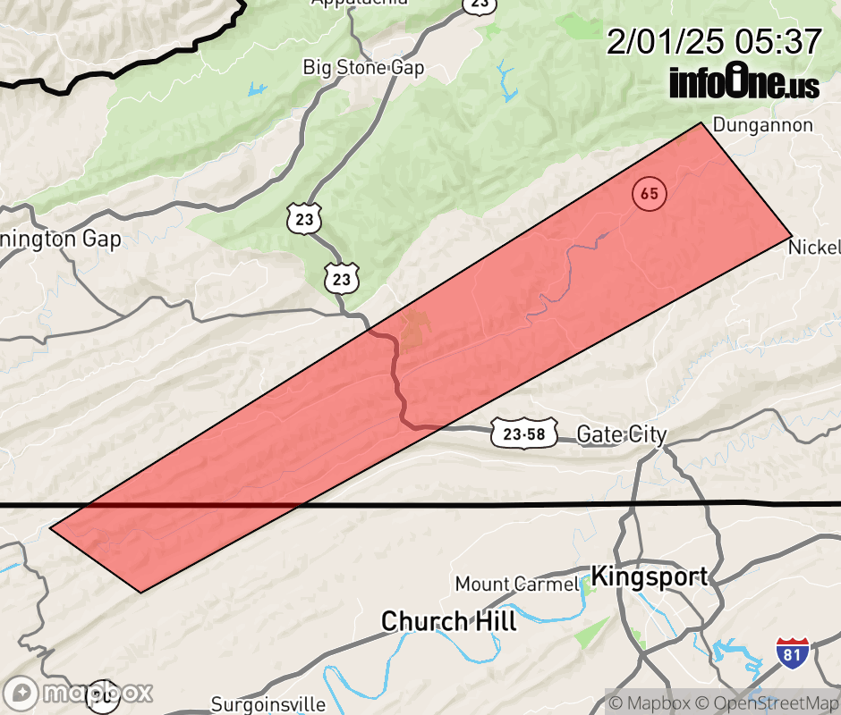 |
|||||||||
 Why aren't you using the InfoOne app? Why aren't you using the InfoOne app?
Stay abreast of information affecting your community! InfoOne tracks real-time information such as:
InfoOne currently supports over 100 communities in NC, VA and WV, and our coverage area is steadily growing. It's free! Install the InfoOne app today and see what you've been missing. |
|||||||||