|
|
Weather Alert |
| Medina County, OH | |||||||||
|
|
||||||||
|
Canceled 3/11/26 12:30 PM Severe Thunderstorm Warning issued March 11 at 11:37AM EDT until March 11 at 12:30PM EDT by NWS Cleveland OH SVRCLE The National Weather Service in Cleveland has issued a * Severe Thunderstorm Warning for... Erie County in north central Ohio... Southwestern Medina County in northeastern Ohio... Ashland County in north central Ohio... Lorain County in north central Ohio... * Until 1230 PM EDT. * At 1137 AM EDT, severe thunderstorms were located along a line extending from Vermilion to near New London to 8 miles west of Savannah, moving northeast at 65 mph. HAZARD...70 mph wind gusts. SOURCE...Radar indicated. IMPACT...Expect considerable tree damage. Damage is likely to mobile homes, roofs, and outbuildings. * Locations impacted include... Lorain, Elyria, Ashland, Western Vermilion, Vermilion, North Ridgeville, Avon Lake, Amherst, Grafton, Wellington, Lodi, New London, Hayesville, Savannah, Polk, Avon, Sheffield Lake, Eaton, Oberlin, and Sheffield. 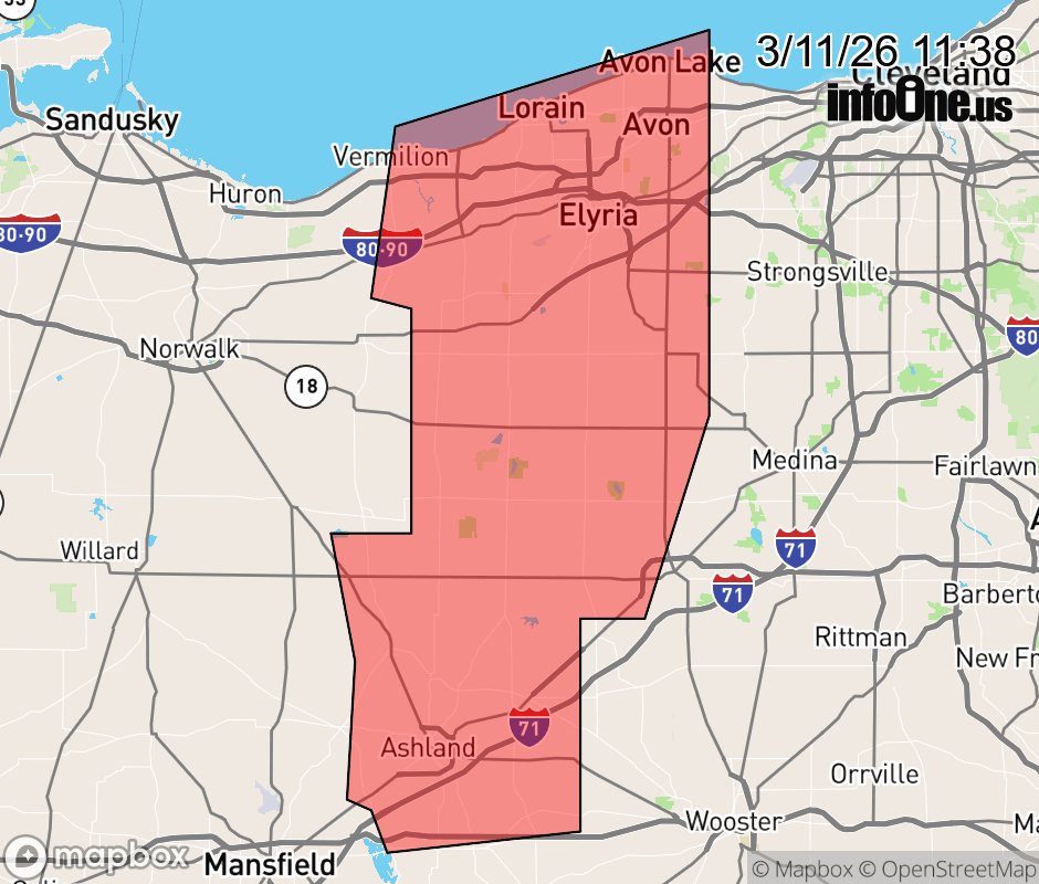 |
|||||||||
 Why aren't you using the InfoOne app? Why aren't you using the InfoOne app?
Stay abreast of information affecting your community! InfoOne tracks real-time information such as:
InfoOne currently supports over 100 communities in NC, VA and WV, and our coverage area is steadily growing. It's free! Install the InfoOne app today and see what you've been missing. |
|||||||||