|
|
Weather Alert |
| Raleigh County, WV | |||||||||
|
|
||||||||
|
Canceled 6/13/21 7:49 PM Severe Thunderstorm Warning issued June 13 at 7:24PM EDT until June 13 at 8:15PM EDT by NWS Charleston WV The National Weather Service in Charleston West Virginia has issued a * Severe Thunderstorm Warning for... Southwestern Pocahontas County in northeastern West Virginia... Southeastern Nicholas County in southeastern West Virginia... Northeastern Raleigh County in southeastern West Virginia... Fayette County in southeastern West Virginia... * Until 815 PM EDT. * At 724 PM EDT, severe thunderstorms were located along a line extending from 7 miles northeast of Beartown State Park to near Oak Hill, moving south at 20 mph. HAZARD...60 mph wind gusts and quarter size hail. SOURCE...Radar indicated. IMPACT...Hail damage to vehicles is expected. Expect wind damage to roofs, siding, and trees. * Locations impacted include... Beckley, Fayetteville, Richwood, Babcock State Park, Oak Hill, Mount Hope, Ansted, Bradley, Hawks Nest State Park, Beaver, Piney View, Stanaford, Daniels, Prosperity, Macarthur, Shady Spring, Powellton, Meadow Bridge, Hillsboro and Thurmond. This includes the following highways... Interstate 64 in West Virginia between mile markers 122 and 137. Route 19 between mile markers 2 and 32. 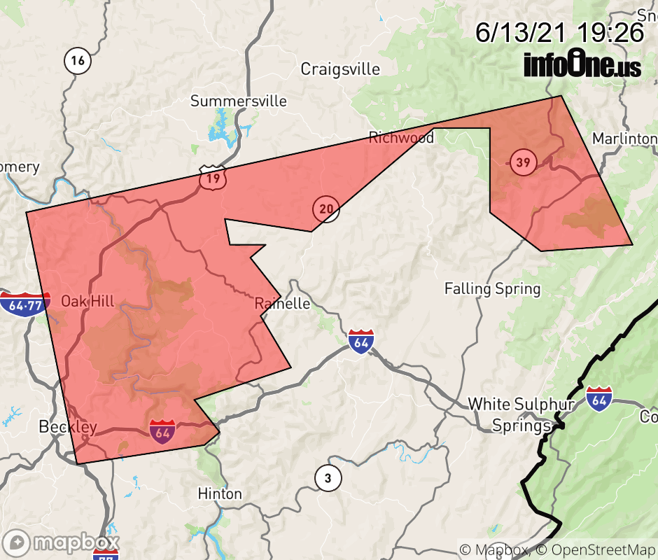 |
|||||||||
 Why aren't you using the InfoOne app? Why aren't you using the InfoOne app?
Stay abreast of information affecting your community! InfoOne tracks real-time information such as:
InfoOne currently supports over 100 communities in NC, VA and WV, and our coverage area is steadily growing. It's free! Install the InfoOne app today and see what you've been missing. |
|||||||||