
|
Weather Alert |
| Johnson County, TN | |||||||||
|
|
||||||||
|
Canceled 10/9/26 12:09 AM High Wind Watch issued October 8 at 1:24PM EDT until October 11 at 8:00AM EDT by NWS Morristown TN * WHAT... Southeast winds 15 to 30 mph with gusts up to 60 mph possible. Potential of 60-80 mph gusts in the mountains and foothills. * WHERE... Blount Smoky Mountains, Cocke Smoky Mountains, Johnson, Sevier Smoky Mountains, Southeast Carter, Southeast Greene, Southeast Monroe, and Unicoi Counties. * WHEN... From Saturday morning through Sunday morning. * IMPACTS... Damaging winds could blow down trees and power lines. Widespread power outages are possible. Travel could be difficult, especially for high profile vehicles. * ADDITIONAL DETAILS... This set up is likely to produce high winds along the eastern TN mountains and foothills. Lower terrain will likely see lesser impacts. 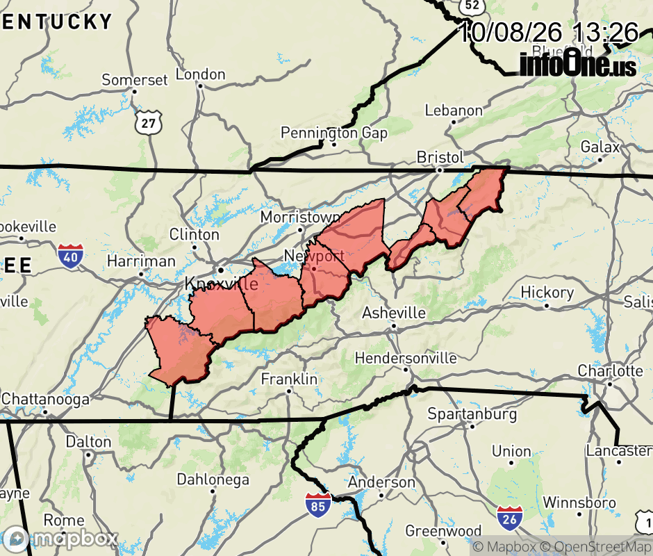 |
|||||||||
 Why aren't you using the InfoOne app? Why aren't you using the InfoOne app?
Stay abreast of information affecting your community! InfoOne tracks real-time information such as:
InfoOne currently supports over 100 communities in NC, VA and WV, and our coverage area is steadily growing. It's free! Install the InfoOne app today and see what you've been missing. |
|||||||||