|
|
Weather Alert |
| Athens County, OH | |||||||||
|
|
||||||||
|
Canceled 5/16/25 11:31 PM Severe Thunderstorm Warning issued May 16 at 11:14PM EDT until May 16 at 11:45PM EDT by NWS Charleston WV SVRRLX The National Weather Service in Charleston West Virginia has issued a * Severe Thunderstorm Warning for... Southeastern Perry County in southeastern Ohio... Northwestern Washington County in southeastern Ohio... Morgan County in southeastern Ohio... Northern Athens County in southeastern Ohio... * Until 1145 PM EDT. * At 1113 PM EDT, severe thunderstorms were located along a line extending from near Shawnee to 6 miles north of Lake Hope State Park, moving east at 60 mph. HAZARD...60 mph wind gusts and half dollar size hail. SOURCE...Radar indicated. IMPACT...Hail damage to vehicles is expected. Expect wind damage to roofs, siding, and trees. * Locations impacted include... Nelsonville, Glouster, McConnelsville, Beverly, Shawnee, Chesterhill, Chauncey, New Straitsville, Malta, Corning, Buchtel, Stockport, Jacksonville, Trimble, Bristol, Hemlock, Amesville, Rendville, Burr Oak State Park, and Hackney. This includes Interstate 77 in Ohio near mile marker 17. 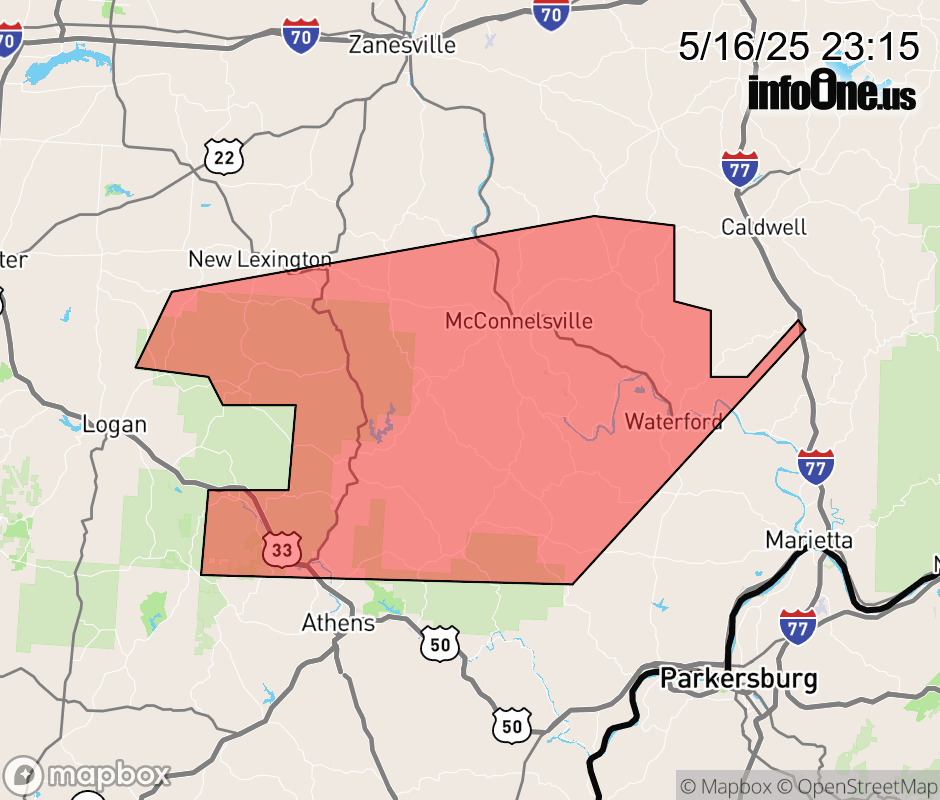 |
|||||||||
 Why aren't you using the InfoOne app? Why aren't you using the InfoOne app?
Stay abreast of information affecting your community! InfoOne tracks real-time information such as:
InfoOne currently supports over 100 communities in NC, VA and WV, and our coverage area is steadily growing. It's free! Install the InfoOne app today and see what you've been missing. |
|||||||||