|
|
Weather Alert |
| Summit County, OH | |||||||||
|
|
||||||||
|
Canceled 4/29/25 4:48 PM Severe Thunderstorm Warning issued April 29 at 4:29PM EDT until April 29 at 5:15PM EDT by NWS Cleveland OH SVRCLE The National Weather Service in Cleveland has issued a * Severe Thunderstorm Warning for... Trumbull County in northeastern Ohio... Mahoning County in northeastern Ohio... Portage County in northeastern Ohio... Southern Geauga County in northeastern Ohio... Southeastern Cuyahoga County in northeastern Ohio... Stark County in northeastern Ohio... Summit County in northeastern Ohio... * Until 515 PM EDT. * At 429 PM EDT, severe thunderstorms were located along a line extending from 6 miles northwest of Cuyahoga Falls to near Waynesburg, moving northeast at 50 mph. HAZARD...60 mph wind gusts and penny size hail. SOURCE...Radar indicated. IMPACT...Expect damage to trees and power lines. * Locations impacted include... Akron, Canton, Youngstown, Warren, Salem, Ravenna, Columbiana, Cuyahoga Falls, Boardman, North Royalton, Kent, Barberton, Green, Solon, Alliance, Hudson, Niles, Twinsburg, Tallmadge, and North Canton. 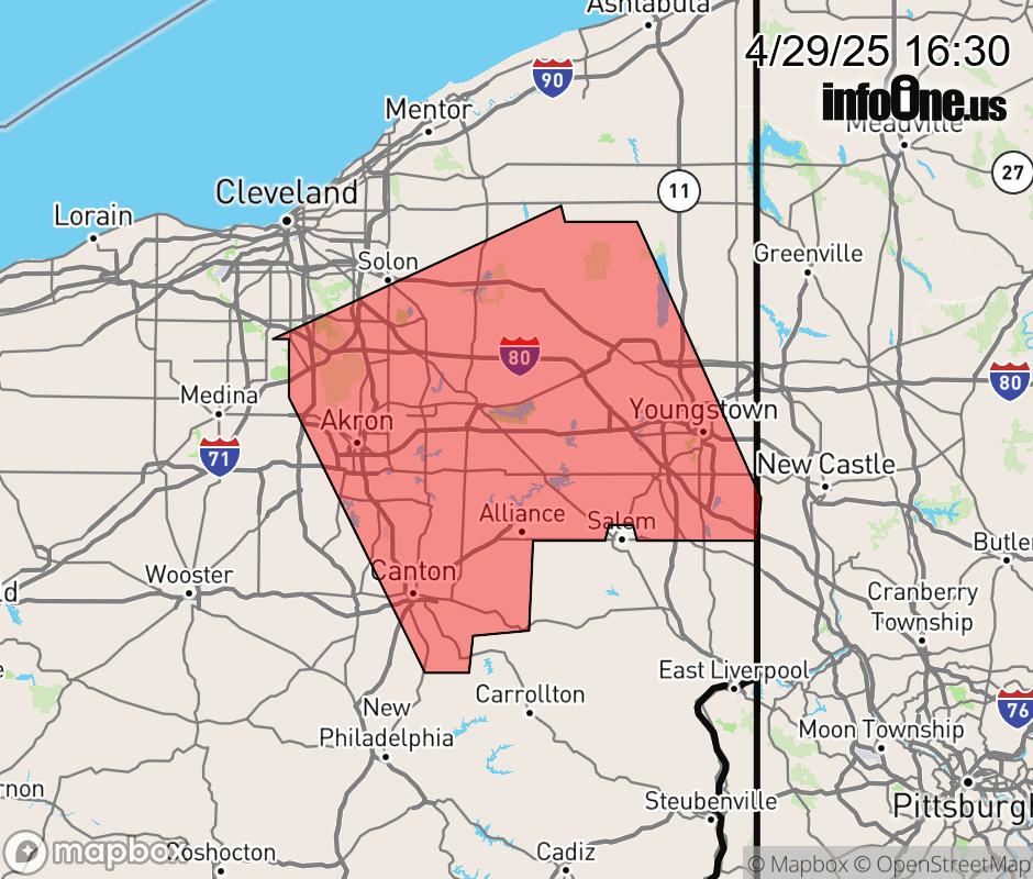 |
|||||||||
 Why aren't you using the InfoOne app? Why aren't you using the InfoOne app?
Stay abreast of information affecting your community! InfoOne tracks real-time information such as:
InfoOne currently supports over 100 communities in NC, VA and WV, and our coverage area is steadily growing. It's free! Install the InfoOne app today and see what you've been missing. |
|||||||||