|
|
Weather Alert |
| Burke County, NC | |||||||||
|
|
||||||||
|
Canceled 9/27/24 10:15 AM Flash Flood Warning issued September 27 at 4:14AM EDT until September 27 at 10:15AM EDT by NWS Greenville-Spartanburg SC FFWGSP The National Weather Service in Greenville-Spartanburg has issued a * Flash Flood Warning for... Burke County in western North Carolina... McDowell County in western North Carolina... * Until 1015 AM EDT Friday. * At 414 AM EDT, doppler radar indicated increasing rainfall rates, with 1 to 2 inches per hour expected. County officials reported ongoing road closures and flooding of structures across the county. Many locations had already received 5 to 9 inches of rain over the last 24 hours, saturating the ground and priming things for the next round. Significant flooding appears likely, resulting in road closures, first-floor inundation, and damage to some structures. The risk of life-threatening landslide activity continues to increase. HAZARD...Life threatening flash flooding. Thunderstorms producing flash flooding. SOURCE...Radar. IMPACT...Life threatening flash flooding of creeks and streams, urban areas, highways, streets and underpasses. Likely first-floor inundation of structures. Increasing risk of landslide activity. * Some locations that will experience flash flooding include... Hickory, Morganton, Marion, Longview, Valdese, Salem, Icard, Drexel, Hildebran, Connelly Springs, Rutherford College, Glen Alpine, Old Fort, Rhodhiss, Lake James State Park, Lake James, Table Rock, South Mountains State Park, B.R. Parkway-Little Switzerland To Linville and Linville Falls. 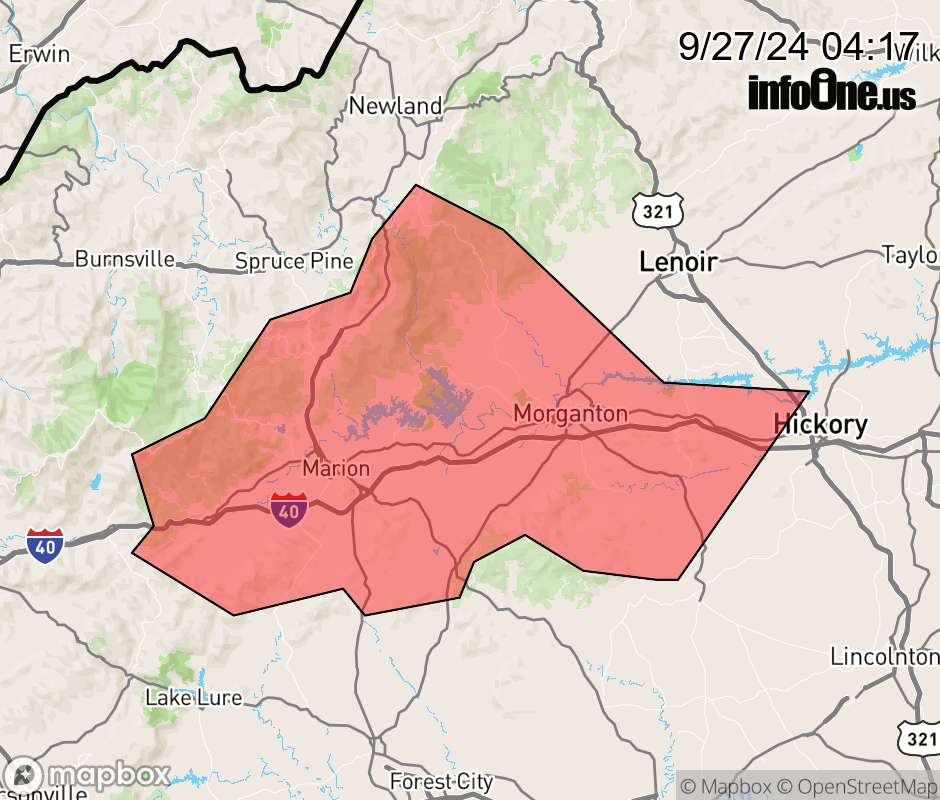 |
|||||||||
 Why aren't you using the InfoOne app? Why aren't you using the InfoOne app?
Stay abreast of information affecting your community! InfoOne tracks real-time information such as:
InfoOne currently supports over 100 communities in NC, VA and WV, and our coverage area is steadily growing. It's free! Install the InfoOne app today and see what you've been missing. |
|||||||||