|
|
Weather Alert |
| Lawrence County, OH | |||||||||
|
|
||||||||
|
Canceled 6/8/21 7:00 PM Special Weather Statement issued June 8 at 6:29PM EDT by NWS Charleston WV At 628 PM EDT, radar indicated strong thunderstorms were located along a line extending from 7 miles southeast of South Webster to Lake Vesuvius to near Coal Grove. Movement was northeast at 25 mph. Wind gusts up to 50 mph and pea size hail are possible with these storms. Locations impacted include... Ashland, Ironton, Coal Grove, Rio Grande, Lake Vesuvius, Gallia, Vernon, Waterloo, Aid, Vinton, Adamsville, Scottown, Gage, Pedro and Centerpoint. Torrential rainfall is also occurring with these storms, and may cause localized flooding. Do not drive your vehicle through flooded roadways. Excessive runoff from heavy rainfall will cause elevated levels on small creeks and streams, ponding of water on country roads and farmland along the banks of creeks and streams, and in urban areas, highways, streets and underpasses, as well as other poor drainage areas and low lying spots. 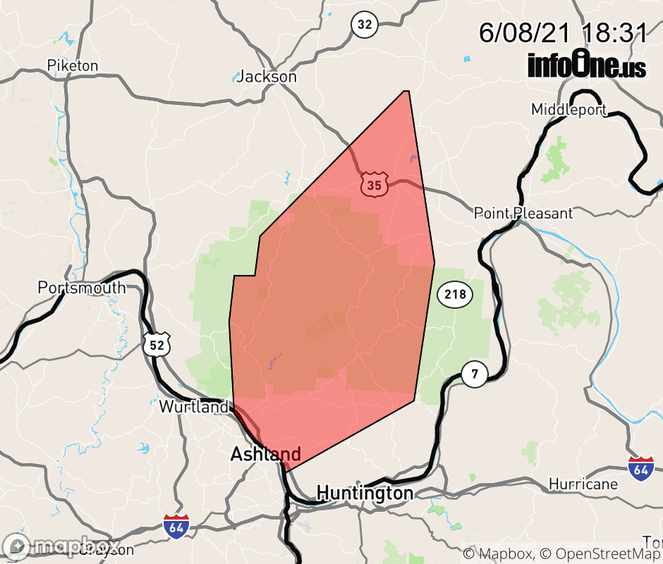 |
|||||||||
 Why aren't you using the InfoOne app? Why aren't you using the InfoOne app?
Stay abreast of information affecting your community! InfoOne tracks real-time information such as:
InfoOne currently supports over 100 communities in NC, VA and WV, and our coverage area is steadily growing. It's free! Install the InfoOne app today and see what you've been missing. |
|||||||||