|
|
Weather Alert |
| Fayette County, WV | |||||||||
|
|
||||||||
|
Canceled 6/8/21 10:30 PM Special Weather Statement issued June 8 at 9:54PM EDT by NWS Charleston WV At 953 PM EDT, radar indicated strong thunderstorms were located along a line extending from near Gauley Bridge to Oak Hill to 6 miles east of Piney View. Movement was northeast at 25 mph. Winds in excess of 40 mph and pea size hail are possible with these storms. Locations impacted include... Summersville, Fayetteville, Rainelle, Babcock State Park, Oak Hill, Mount Hope, Ansted, Gauley Bridge, Hawks Nest State Park, Piney View, Stanaford, Bradley, Thurmond, Swiss, Kesslers Cross Lanes, Drennan and Mount Nebo. This includes Route 19 between mile markers 5 and 39. Torrential rainfall is also occurring with these storms, and may cause localized flooding. Do not drive your vehicle through flooded roadways. Frequent cloud to ground lightning is occurring with this storm. Lightning can strike 10 miles away from a thunderstorm. Seek a safe shelter inside a building or vehicle. Excessive runoff from heavy rainfall will cause elevated levels on small creeks and streams, and ponding of water on country roads and farmland along the banks of creeks and streams. 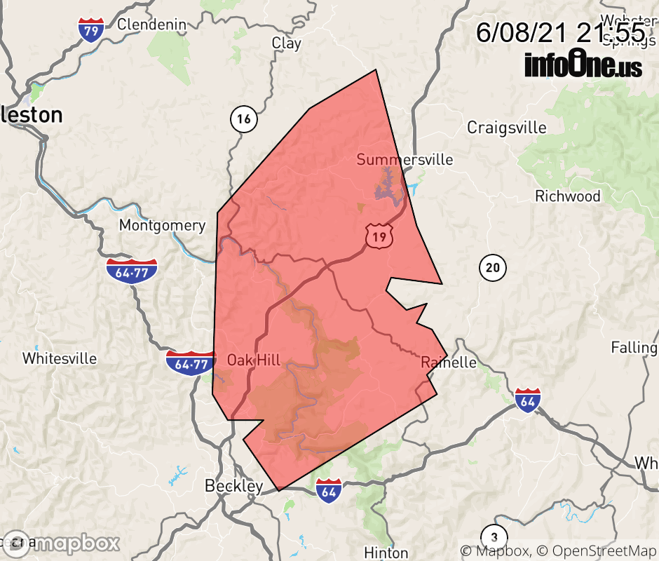 |
|||||||||
 Why aren't you using the InfoOne app? Why aren't you using the InfoOne app?
Stay abreast of information affecting your community! InfoOne tracks real-time information such as:
InfoOne currently supports over 100 communities in NC, VA and WV, and our coverage area is steadily growing. It's free! Install the InfoOne app today and see what you've been missing. |
|||||||||