|
|
Weather Alert |
| Durham County, NC | |||||||||
|
|
||||||||
|
Canceled 1/9/25 2:42 PM Winter Storm Watch issued January 9 at 9:24AM EST until January 11 at 10:00AM EST by NWS Raleigh NC * WHAT... Mixed wintry precipitation is expected. Total snow and sleet accumulations range from a dusting up to 3 inches, highest along and north of I-85. Total ice accumulations of a tenth to two tenths will be possible mainly over the southern Piedmont, Sandhills, into the central and southern Coastal Plain. * WHERE... All of central North Carolina * WHEN...As early as Friday afternoon in the western Piedmont and spreading east Friday night. * IMPACTS... Roads, and especially bridges and overpasses, will likely become slick and hazardous. * ADDITIONAL DETAILS... Snow and sleet are expected Friday afternoon into the evening hours. Mixed precipitation will then spread northward Friday night into Saturday including transitions to sleet, freezing rain, and some all rain. Confidence is low on exact precipitation types, where they will ultimately develop, and associated totals of snow and ice accumulation. However, confidence is increasing that minor to moderate impacts will be possible Friday afternoon into Saturday morning. 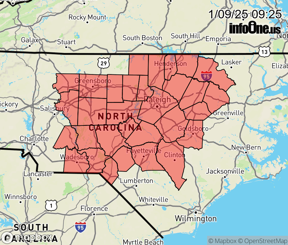 |
|||||||||
 Why aren't you using the InfoOne app? Why aren't you using the InfoOne app?
Stay abreast of information affecting your community! InfoOne tracks real-time information such as:
InfoOne currently supports over 100 communities in NC, VA and WV, and our coverage area is steadily growing. It's free! Install the InfoOne app today and see what you've been missing. |
|||||||||