|
|
Weather Alert |
| Monroe County, OH | |||||||||
|
|
||||||||
|
Canceled 6/6/26 8:53 PM Severe Thunderstorm Warning issued June 6 at 8:44PM EDT until June 6 at 9:30PM EDT by NWS Pittsburgh PA SVRPBZ The National Weather Service in Pittsburgh has issued a * Severe Thunderstorm Warning for... Southwestern Belmont County in east central Ohio... Northeastern Guernsey County in east central Ohio... North Central Monroe County in east central Ohio... Northeastern Noble County in east central Ohio... * Until 930 PM EDT. * At 844 PM EDT, a severe thunderstorm was located 10 miles northeast of Byesville, or 11 miles east of Cambridge, moving southeast at 35 mph. HAZARD...60 mph wind gusts and quarter size hail. SOURCE...Radar indicated. IMPACT...Hail damage to vehicles is expected. Expect wind damage to roofs, siding, and trees. * Locations impacted include... Barnesville, Woodsfield, Bethesda, Antrim, Quaker City, Belmont, Beallsville, Old Washington, Jerusalem, Salesville, Wilson, Somerton, Alledonia, Fairview, Batesville, Miltonsburg and Salt Fork State Park. 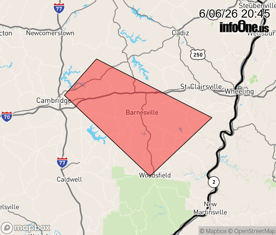 |
|||||||||
 Why aren't you using the InfoOne app? Why aren't you using the InfoOne app?
Stay abreast of information affecting your community! InfoOne tracks real-time information such as:
InfoOne currently supports over 100 communities in NC, VA and WV, and our coverage area is steadily growing. It's free! Install the InfoOne app today and see what you've been missing. |
|||||||||