|
|
Weather Alert |
| Athens County, OH | |||||||||
|
|
||||||||
|
Canceled 3/7/26 3:30 PM Special Weather Statement issued March 7 at 2:53PM EST by NWS Charleston WV At 252 PM EST, Doppler radar was tracking a strong thunderstorm near Glouster, moving northeast at 45 mph. HAZARD...Wind gusts up to 50 mph and penny size hail. SOURCE...Radar indicated. IMPACT...Gusty winds could knock down tree limbs and blow around unsecured objects. Minor hail damage to vegetation is possible. Locations impacted include... Glouster, Chesterhill, Stockport, Jacksonville, Trimble, and Burr Oak State Park. 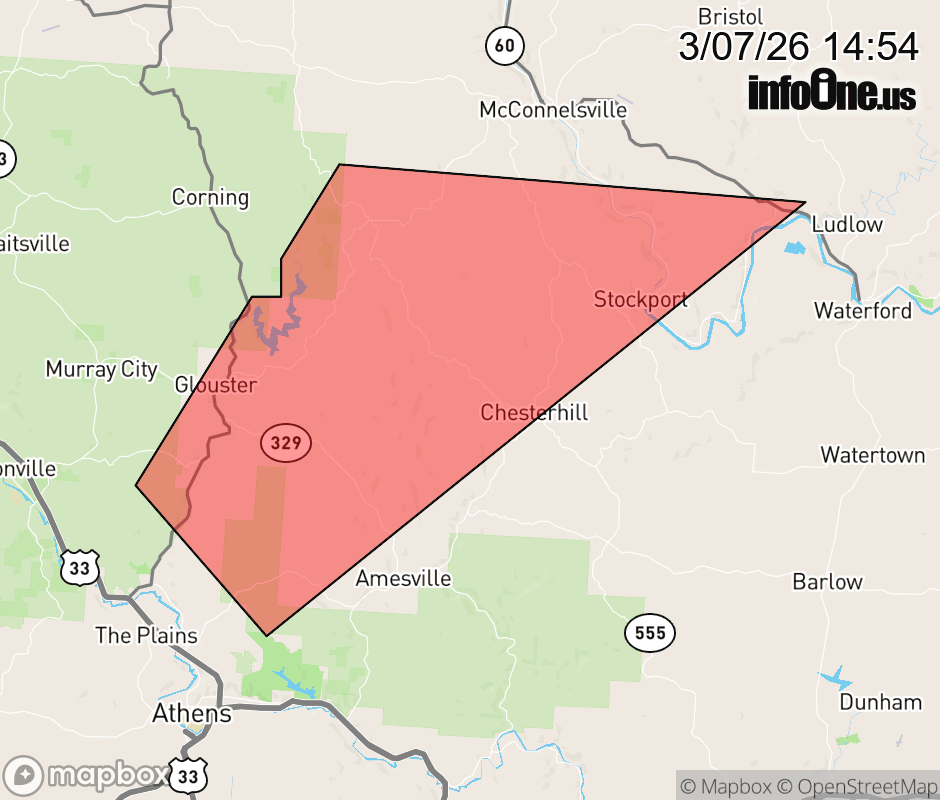 |
|||||||||
 Why aren't you using the InfoOne app? Why aren't you using the InfoOne app?
Stay abreast of information affecting your community! InfoOne tracks real-time information such as:
InfoOne currently supports over 100 communities in NC, VA and WV, and our coverage area is steadily growing. It's free! Install the InfoOne app today and see what you've been missing. |
|||||||||