|
|
Weather Alert |
| Hampshire County, WV | |||||||||
|
|
||||||||
|
Canceled 4/19/25 9:22 PM Severe Thunderstorm Warning issued April 19 at 9:10PM EDT until April 19 at 9:45PM EDT by NWS Baltimore MD/Washington DC SVRLWX The National Weather Service in Sterling Virginia has issued a * Severe Thunderstorm Warning for... Central Allegany County in western Maryland... Southwestern Morgan County in the Panhandle of West Virginia... Northeastern Mineral County in eastern West Virginia... Northeastern Hampshire County in eastern West Virginia... * Until 945 PM EDT. * At 910 PM EDT, severe thunderstorms were located along a line extending from near Bel Air to near Westernport to near Elk Garden, moving east at 75 mph. HAZARD...60 mph wind gusts and quarter size hail. SOURCE...Radar indicated. IMPACT...Damaging winds will cause some trees and large branches to fall. This could injure those outdoors, as well as damage homes and vehicles. Roadways may become blocked by downed trees. Localized power outages are possible. Unsecured light objects may become projectiles. * Locations impacted include... Potomac Park, Bel Air, Fort Ashby, Valley View, Fishers Bridge, Short Gap, Pumpkin Center, North Branch, Rock Gap, Bloomery, Reeses Mill, Brady, Points, Oldtown, Smith Crossroads, Cresaptown, Omps, Rawlings, Patterson Creek, and Three Churches. 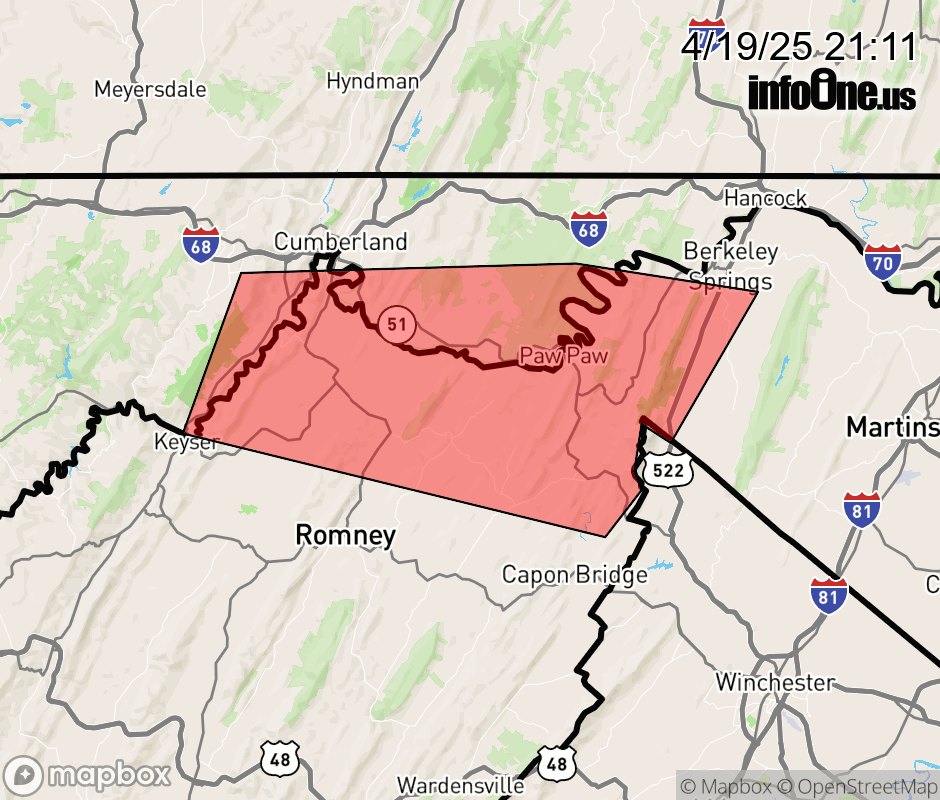 |
|||||||||
 Why aren't you using the InfoOne app? Why aren't you using the InfoOne app?
Stay abreast of information affecting your community! InfoOne tracks real-time information such as:
InfoOne currently supports over 100 communities in NC, VA and WV, and our coverage area is steadily growing. It's free! Install the InfoOne app today and see what you've been missing. |
|||||||||