|
|
Weather Alert |
| Calhoun County, WV | |||||||||
|
|
||||||||
|
Canceled 11/15/25 11:30 PM Severe Thunderstorm Warning issued November 15 at 10:57PM EST until November 15 at 11:30PM EST by NWS Charleston WV SVRRLX The National Weather Service in Charleston West Virginia has issued a * Severe Thunderstorm Warning for... Northeastern Calhoun County in north central West Virginia... Central Gilmer County in north central West Virginia... South central Lewis County in northern West Virginia... Northeastern Braxton County in north central West Virginia... * Until 1130 PM EST. * At 1056 PM EST, a severe thunderstorm was located near Cedar Creek State Park, or near Glenville, moving southeast at 45 mph. HAZARD...60 mph wind gusts. SOURCE...Radar indicated. IMPACT...Expect damage to roofs, siding, and trees. * Locations impacted include... Glenville, Cedar Creek State Park, Burnsville, Flatwoods, Sand Fork, Stouts Mills, Exchange, Heaters, Walkersville, Ireland, Stumptown, Cedarville, Centralia, Normantown, and Falls Mills. This includes Interstate 79 between mile markers 65 and 83. 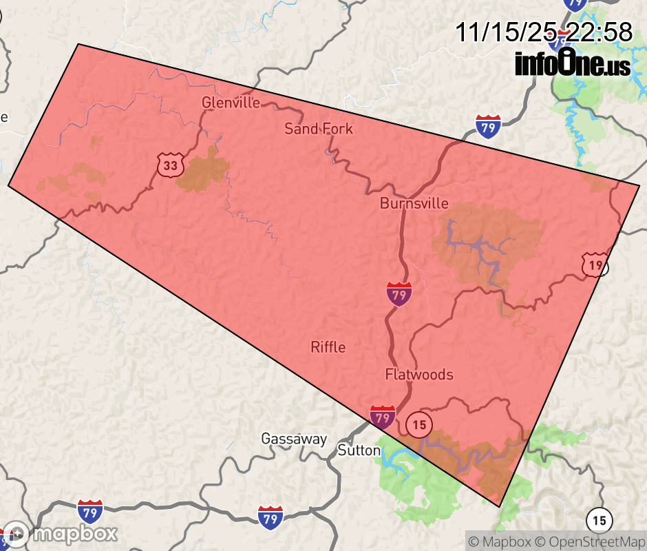 |
|||||||||
 Why aren't you using the InfoOne app? Why aren't you using the InfoOne app?
Stay abreast of information affecting your community! InfoOne tracks real-time information such as:
InfoOne currently supports over 100 communities in NC, VA and WV, and our coverage area is steadily growing. It's free! Install the InfoOne app today and see what you've been missing. |
|||||||||