|
|
Weather Alert |
| Frederick County, VA | |||||||||
|
|
||||||||
|
Canceled 5/20/26 2:56 PM Severe Thunderstorm Warning issued May 20 at 2:35PM EDT until May 20 at 3:00PM EDT by NWS Baltimore MD/Washington DC SVRLWX The National Weather Service in Sterling Virginia has issued a * Severe Thunderstorm Warning for... West central Frederick County in northwestern Virginia... Southeastern Hampshire County in eastern West Virginia... * Until 300 PM EDT. * At 235 PM EDT, a severe thunderstorm was located 10 miles north of Wardensville, or 15 miles southeast of Romney, moving east at 20 mph. HAZARD...60 mph wind gusts. SOURCE...Radar indicated. IMPACT...Damaging winds will cause some trees and large branches to fall. This could injure those outdoors, as well as damage homes and vehicles. Roadways may become blocked by downed trees. Localized power outages are possible. Unsecured light objects may become projectiles. * Locations impacted include... Capon Bridge, Yellow Spring, High View, Timber Ridge, Rock Enon Springs, and Lehew. 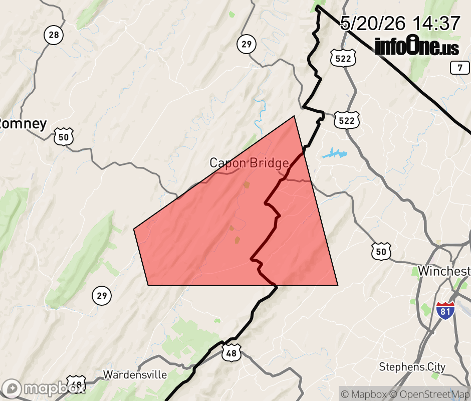 |
|||||||||
 Why aren't you using the InfoOne app? Why aren't you using the InfoOne app?
Stay abreast of information affecting your community! InfoOne tracks real-time information such as:
InfoOne currently supports over 100 communities in NC, VA and WV, and our coverage area is steadily growing. It's free! Install the InfoOne app today and see what you've been missing. |
|||||||||