|
|
Weather Alert |
| Tyler County, WV | |||||||||
|
|
||||||||
|
Canceled 4/14/24 12:37 AM Flood Warning issued April 12 at 11:07PM EDT until April 13 at 2:00AM EDT by NWS Charleston WV * WHAT... Flooding caused by prior excessive rainfall continues. * WHERE... Portions of southeast Ohio, including the following county, Washington and West Virginia, including the following counties, Doddridge, Jackson, Pleasants, Ritchie, Roane, Tyler, Wirt and Wood. * WHEN... Until 200 AM EDT. * IMPACTS... Flooding of rivers, creeks, streams, and other low-lying and flood-prone locations is imminent or occurring. * ADDITIONAL DETAILS... - At 1104 PM EDT, larger creeks continue to cause flooding issues, particularly Middle Island Creek. Additionally, some of the typical low-lying trouble spots may also remain under high water. - Some locations that will experience flooding include... Ripley, Harrisville, St. Marys, Elizabeth, Middlebourne, Paden City, Sistersville, Pennsboro, Belmont, North Bend State Park, Mineralwells, Sandyville, Newport, Matamoras, Ellenboro, Cairo, Reedy, Friendly, Petroleum and Nutter Farm. - http://www.weather.gov/safety/flood 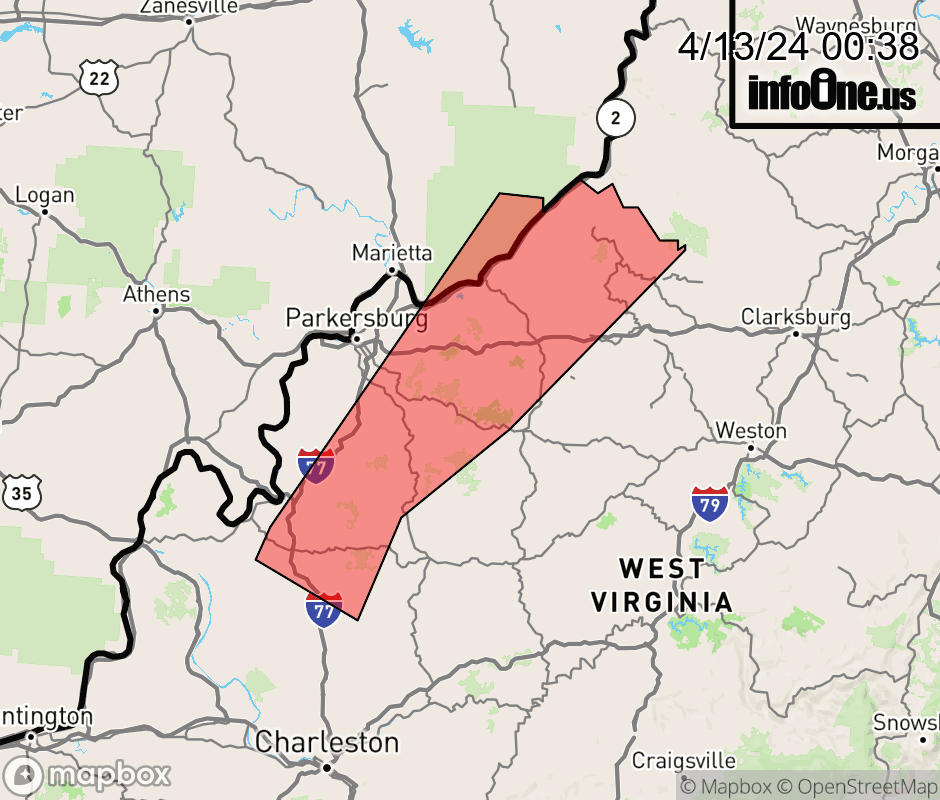 |
|||||||||
 Why aren't you using the InfoOne app? Why aren't you using the InfoOne app?
Stay abreast of information affecting your community! InfoOne tracks real-time information such as:
InfoOne currently supports over 100 communities in NC, VA and WV, and our coverage area is steadily growing. It's free! Install the InfoOne app today and see what you've been missing. |
|||||||||