|
|
Weather Alert |
| Lewis County, WV | |||||||||
|
|
||||||||
|
Canceled 7/4/26 1:52 PM Severe Thunderstorm Warning issued July 4 at 1:39PM EDT until July 4 at 2:15PM EDT by NWS Charleston WV SVRRLX The National Weather Service in Charleston West Virginia has issued a * Severe Thunderstorm Warning for... Southeastern Ritchie County in northwestern West Virginia... Southern Doddridge County in northern West Virginia... Northeastern Gilmer County in north central West Virginia... Northwestern Lewis County in northern West Virginia... Southwestern Harrison County in northern West Virginia... * Until 215 PM EDT. * At 138 PM EDT, a severe thunderstorm was located 12 miles northeast of Glenville, moving east at 15 mph. Another severe thunderstorm was located Cox Mills, also moving east at 15 mph. HAZARD...60 mph wind gusts and quarter size hail. SOURCE...Radar indicated. IMPACT...Hail damage to vehicles is expected. Expect wind damage to roofs, siding, and trees. * Locations impacted include... Weston, Stonewall Jackson, Jackson Mill, Auburn, Camden, Avon, Grove, Leopold, Troy, Newberne, Alum Bridge, Coxs Mills, and Linn. This includes Interstate 79 between mile markers 93 and 96. 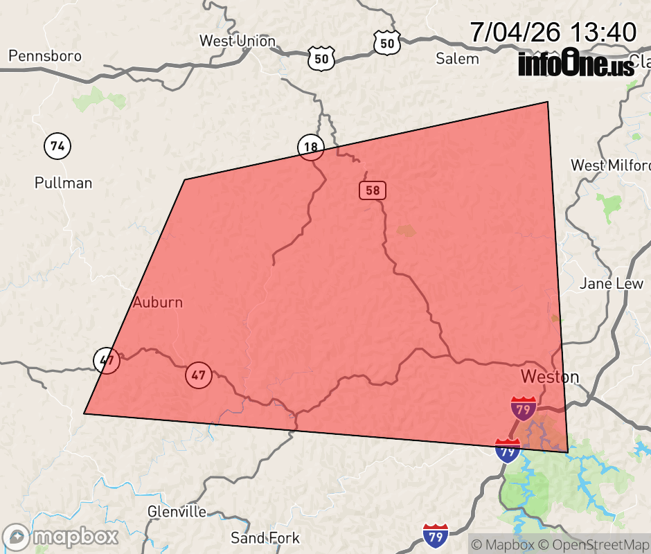 |
|||||||||
 Why aren't you using the InfoOne app? Why aren't you using the InfoOne app?
Stay abreast of information affecting your community! InfoOne tracks real-time information such as:
InfoOne currently supports over 100 communities in NC, VA and WV, and our coverage area is steadily growing. It's free! Install the InfoOne app today and see what you've been missing. |
|||||||||