
|
Weather Alert |
| McDowell County, NC | |||||||||
|
|
||||||||
|
Canceled 7/13/26 4:44 PM Flood Advisory issued July 13 at 1:20PM EDT until July 13 at 7:15PM EDT by NWS Greenville-Spartanburg SC * WHAT... Flooding caused by excessive rainfall is expected. * WHERE... South Central McDowell County in western North Carolina... * WHEN... Until 715 PM EDT. * IMPACTS... Nuisance flooding of low-lying areas adjacent to streams and other poor-drainage areas, including farmland, parks, greenways, boat-access areas, golf courses, underpasses, and parking lots. Isolated, shallow flows over roadways is possible. A few flood-prone, low-water crossings may become impassible. A small culvert washout or two is possible. * ADDITIONAL DETAILS... - At 115 PM EDT, Doppler radar and automated rain gauges indicated heavy rain due to very slow moving heavy showers. Areas of central McDowell County near Marion, Pleasant Gardens, Glenwood, and Sugar Hill and have received 1-2 inches of rainfall with an additional 1-2 inches possible. This rainfall is occurring over saturated soils which are prone to excessive runoff. Therefore, expect rapid rises on small streams in the headwaters of Muddy Creek the Second Broad River, Cove Creek and the upper Catawba River, with potential impacts to low-lying, flood-prone areas and low- elevation bridges and culverts over several tributaries, including Nix Creek, Youngs Fork, Rock Creek, and Glades Creek. Flooding near Zion Hill Rd, Sugar Hill Rd, and Marler Rd may be imminent. - Some locations that may experience flooding include... Marion, Sugar Hill, Glenwood, Fero, Pleasant Gardens and Thermal City. - Http://www.weather.gov/safety/flood 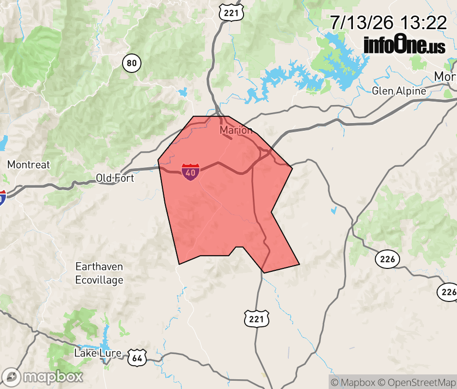 |
|||||||||
 Why aren't you using the InfoOne app? Why aren't you using the InfoOne app?
Stay abreast of information affecting your community! InfoOne tracks real-time information such as:
InfoOne currently supports over 100 communities in NC, VA and WV, and our coverage area is steadily growing. It's free! Install the InfoOne app today and see what you've been missing. |
|||||||||