|
|
Weather Alert |
| Franklin County, OH | |||||||||
|
|
||||||||
|
Canceled 6/18/25 7:37 PM Severe Thunderstorm Warning issued June 18 at 7:26PM EDT until June 18 at 8:30PM EDT by NWS Wilmington OH SVRILN The National Weather Service in Wilmington has issued a * Severe Thunderstorm Warning for... Southeastern Champaign County in west central Ohio... Western Franklin County in central Ohio... Fayette County in central Ohio... Northwestern Pickaway County in central Ohio... South central Delaware County in central Ohio... Eastern Greene County in west central Ohio... Eastern Clark County in west central Ohio... Madison County in central Ohio... * Until 830 PM EDT. * At 725 PM EDT, severe thunderstorms were located along a line extending from near Mechanicsburg to 6 miles south of Xenia, moving east at 35 mph. HAZARD...70 mph wind gusts. SOURCE...A 69 mph wind gust was reported at Dayton Airport at 654 pm. IMPACT...Expect considerable tree damage. Damage is likely to mobile homes, roofs, and outbuildings. * Locations impacted include... Columbus, Springfield, Dublin, Grove City, Upper Arlington, Hilliard, Washington Court House, Worthington, London, Jefferson, Powell, Plain City, West Jefferson, Cedarville, Jamestown, Mount Sterling, South Charleston, Mechanicsburg, Jeffersonville, and Bloomingburg. This includes the following Interstates... I-70 in Ohio between mile markers 59 and 95. I-71 in Ohio between mile markers 58 and 94. 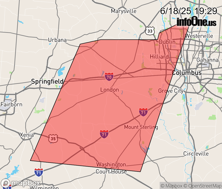 |
|||||||||
 Why aren't you using the InfoOne app? Why aren't you using the InfoOne app?
Stay abreast of information affecting your community! InfoOne tracks real-time information such as:
InfoOne currently supports over 100 communities in NC, VA and WV, and our coverage area is steadily growing. It's free! Install the InfoOne app today and see what you've been missing. |
|||||||||