|
|
Weather Alert |
| Mingo County, WV | |||||||||
|
|
||||||||
|
Canceled 4/1/26 3:58 PM Severe Thunderstorm Warning issued April 1 at 3:29PM EDT until April 1 at 4:15PM EDT by NWS Charleston WV SVRRLX The National Weather Service in Charleston West Virginia has issued a * Severe Thunderstorm Warning for... Southeastern Mingo County in southern West Virginia... West central Raleigh County in southeastern West Virginia... Northwestern Wyoming County in southern West Virginia... Logan County in southern West Virginia... Southeastern Boone County in central West Virginia... * Until 415 PM EDT. * At 329 PM EDT, a severe thunderstorm was located near Holden, or 7 miles south of Logan, moving east at 35 mph. HAZARD...Quarter size hail. SOURCE...Radar indicated. IMPACT...Damage to vehicles is expected. * Locations impacted include... Logan, Oceana, Man, Delbarton, R.d. Bailey Lake, Mount Gay-Shamrock, Bald Knob, Holden, Mallory, Amherstdale-Robinette, Chief Logan State Park, Red Jacket, Hinch, Gilbert Creek, Matewan, Gilbert, West Logan, Mount Gay, Chauncey, and Coal Mountain. This includes Route 119 between mile markers 18 and 29. 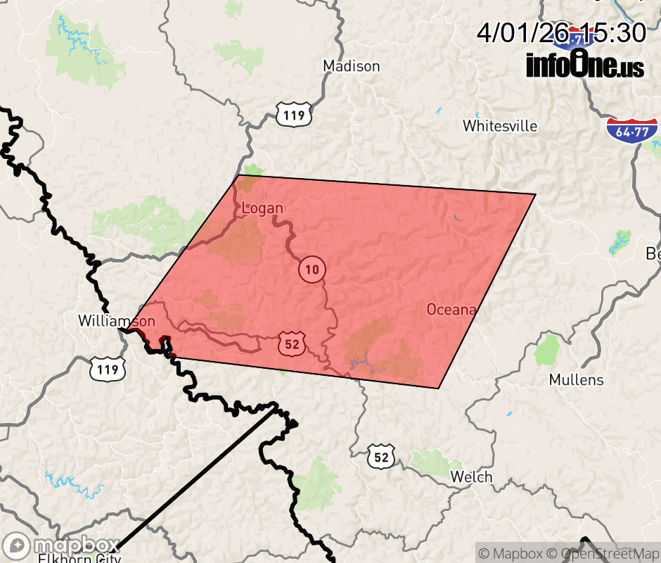 |
|||||||||
 Why aren't you using the InfoOne app? Why aren't you using the InfoOne app?
Stay abreast of information affecting your community! InfoOne tracks real-time information such as:
InfoOne currently supports over 100 communities in NC, VA and WV, and our coverage area is steadily growing. It's free! Install the InfoOne app today and see what you've been missing. |
|||||||||