|
|
Weather Alert |
| Lewis County, WV | |||||||||
|
|
||||||||
|
Canceled 7/4/26 1:58 PM Severe Thunderstorm Warning issued July 4 at 1:51PM EDT until July 4 at 2:15PM EDT by NWS Charleston WV At 150 PM EDT, a severe thunderstorm was located 10 miles west of Jackson Mill, or 11 miles west of Weston, moving east at 15 mph. HAZARD...60 mph wind gusts and quarter size hail. SOURCE...Radar indicated. IMPACT...Hail damage to vehicles is expected. Expect wind damage to roofs, siding, and trees. Locations impacted include... Weston, Stonewall Jackson, Jackson Mill, Camden, Newberne, Alum Bridge, Coxs Mills, Linn, Avon, Grove, Leopold, and Troy. 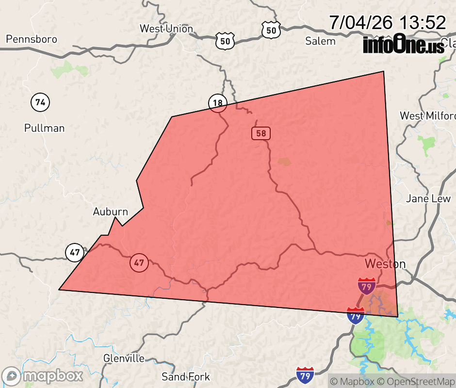 |
|||||||||
 Why aren't you using the InfoOne app? Why aren't you using the InfoOne app?
Stay abreast of information affecting your community! InfoOne tracks real-time information such as:
InfoOne currently supports over 100 communities in NC, VA and WV, and our coverage area is steadily growing. It's free! Install the InfoOne app today and see what you've been missing. |
|||||||||