|
|
Weather Alert |
| Highland County, VA | |||||||||
|
|
||||||||
|
Canceled 1/11/26 12:15 PM Special Weather Statement issued January 11 at 11:34AM EST by NWS Baltimore MD/Washington DC At 1132 AM EST, heavy snow showers were located along a line extending from near Franklin to 8 miles northwest of Burnsville. Movement was southeast at 25 mph. Winds in excess of 30 mph are possible and visibilities will drop quickly to less than a quarter of a mile. Locations impacted include... Franklin, Monterey, Brandywine, Clover Creek, Doe Hill, Head Waters, Bolar, Liberty, Harper, Palo Alto, Oak Flat, Mustoe, Mcdowell, Possum Trot, Vanderpool, Moyers, Sirons Mill, Sugar Grove, and Williamsville. Use extra caution if you must travel. Rapid changes in visibility and potentially slick roads will lead to hazardous driving conditions. 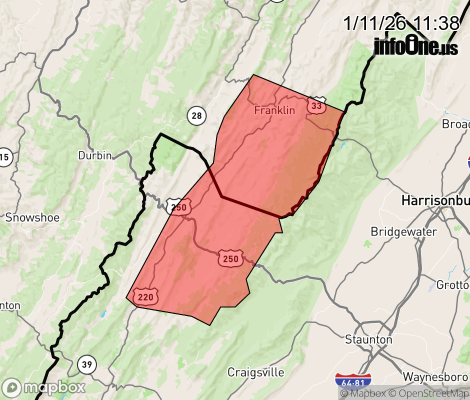 |
|||||||||
 Why aren't you using the InfoOne app? Why aren't you using the InfoOne app?
Stay abreast of information affecting your community! InfoOne tracks real-time information such as:
InfoOne currently supports over 100 communities in NC, VA and WV, and our coverage area is steadily growing. It's free! Install the InfoOne app today and see what you've been missing. |
|||||||||