|
|
Weather Alert |
| Franklin County, OH | |||||||||
|
|
||||||||
|
Canceled 6/18/25 8:30 PM Severe Thunderstorm Warning issued June 18 at 8:21PM EDT until June 18 at 8:30PM EDT by NWS Wilmington OH At 820 PM EDT, severe thunderstorms were located along a line extending from Powell to near Bloomingburg, moving east at 35 mph. HAZARD...60 mph wind gusts. SOURCE...Radar indicated. IMPACT...Expect damage to trees and power lines. Locations impacted include... Columbus, Dublin, Grove City, Upper Arlington, Hilliard, Washington Court House, Worthington, Jefferson, Powell, West Jefferson, Mount Sterling, Jeffersonville, Bloomingburg, New Holland, Lake Darby, Valleyview, Marble Cliff, Riverlea, Harrisburg, and Orient. This includes the following Interstates... I-70 in Ohio between mile markers 84 and 95. I-71 in Ohio between mile markers 72 and 94. 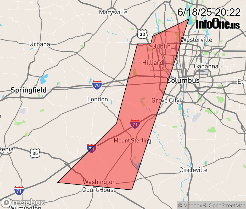 |
|||||||||
 Why aren't you using the InfoOne app? Why aren't you using the InfoOne app?
Stay abreast of information affecting your community! InfoOne tracks real-time information such as:
InfoOne currently supports over 100 communities in NC, VA and WV, and our coverage area is steadily growing. It's free! Install the InfoOne app today and see what you've been missing. |
|||||||||