|
|
Weather Alert |
| Durham County, NC | |||||||||
|
|
||||||||
|
Canceled 3/16/26 7:28 PM Severe Thunderstorm Warning issued March 16 at 7:02PM EDT until March 16 at 7:45PM EDT by NWS Raleigh NC At 702 PM EDT, severe thunderstorms were located along a line extending from near Scottsburg to 10 miles south of Clarksville to 7 miles north of Benson to near Jerome, moving northeast at 45 mph. HAZARD...60 mph wind gusts. SOURCE...Radar indicated. IMPACT...Expect damage to roofs, siding, and trees. Locations impacted include... Raleigh, Fayetteville, Cary, Henderson, Smithfield, Clinton, Oxford, Creedmoor, Louisburg, and Warrenton. This includes the following highways... Interstate 95 between Mile Markers 105 and 46. Interstate 85 between Mile Markers 188 and 233. Interstate 40 between Mile Markers 288 and 351. Interstate 440 between Mile Markers 1 and 16. Interstate 540 between Mile Markers 5 and 24. US 1 near Mile Marker 101. NC Highway 264 between Mile Markers 20 and 29. 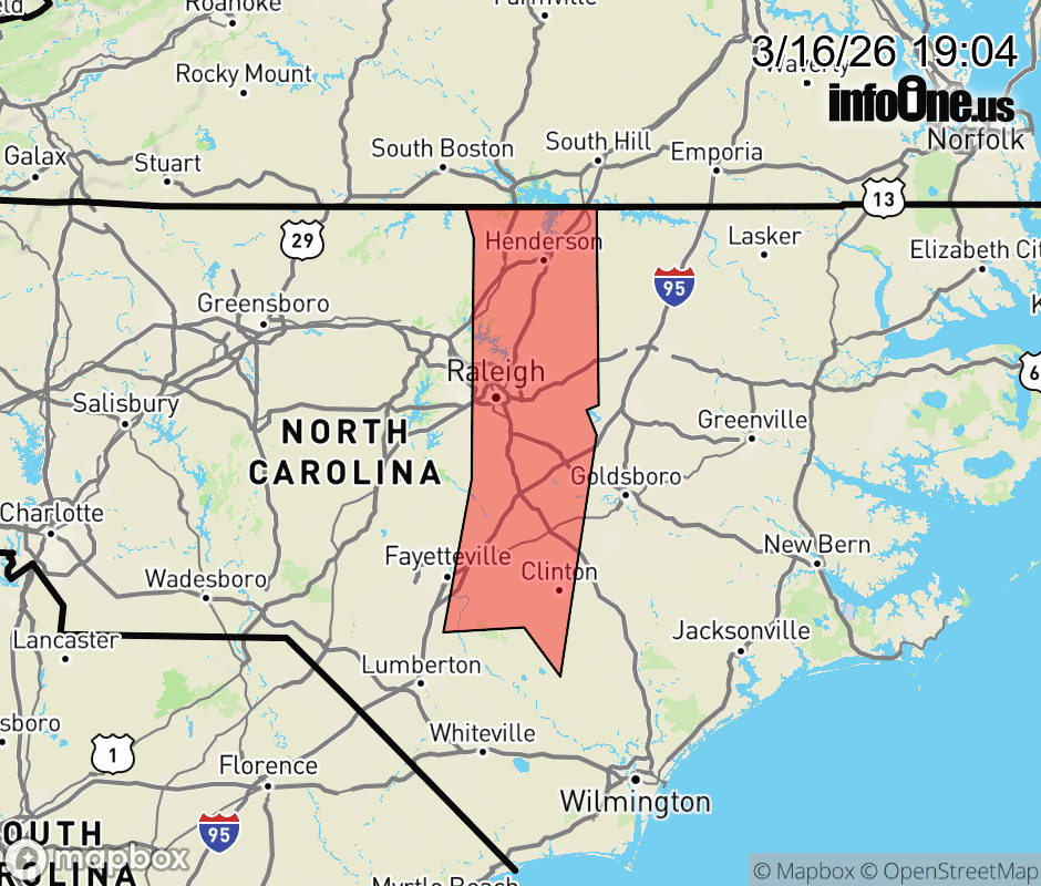 |
|||||||||
 Why aren't you using the InfoOne app? Why aren't you using the InfoOne app?
Stay abreast of information affecting your community! InfoOne tracks real-time information such as:
InfoOne currently supports over 100 communities in NC, VA and WV, and our coverage area is steadily growing. It's free! Install the InfoOne app today and see what you've been missing. |
|||||||||