|
|
Weather Alert |
| Stark County, OH | |||||||||
|
|
||||||||
|
Canceled 1/27/26 7:00 PM Special Weather Statement issued January 27 at 5:54PM EST by NWS Cleveland OH At 554 PM EST, radar indicated snow showers along a line extending from 6 miles west of Newton Falls to near Louisville to Wilmot, moving east at 30 mph. HAZARDS INCLUDE... Winds to 40 mph... Visibility dropping to less than three quarters of a mile... Up to 1 inch of quick snow accumulation... Locations impacted include... Canton, Youngstown, Warren, Salem, Ravenna, Columbiana, Boardman, Massillon, Green, Alliance, Niles, North Canton, Louisville, Campbell, Hubbard, Canfield, Cortland, Newton Falls, Sebring, and Minerva. Use extra caution if you must travel. Rapid changes in visibility and potentially slick roads may lead to accidents. 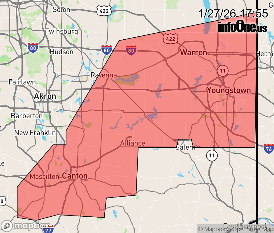 |
|||||||||
 Why aren't you using the InfoOne app? Why aren't you using the InfoOne app?
Stay abreast of information affecting your community! InfoOne tracks real-time information such as:
InfoOne currently supports over 100 communities in NC, VA and WV, and our coverage area is steadily growing. It's free! Install the InfoOne app today and see what you've been missing. |
|||||||||