|
|
Weather Alert |
| Pocahontas County, WV | |||||||||
|
|
||||||||
|
Canceled 7/18/25 7:00 PM Special Weather Statement issued July 18 at 5:56PM EDT by NWS Charleston WV At 554 PM EDT, Doppler radar was tracking a thunderstorm with heavy rainfall 7 miles south of Greenbank, moving east at 10 mph. HAZARD...Heavy rainfall. SOURCE...Radar indicated. IMPACT...Area creeks and streams will run high and swift. Minor flooding possible in low lying spots. Locations impacted include... Dunmore and Frost. 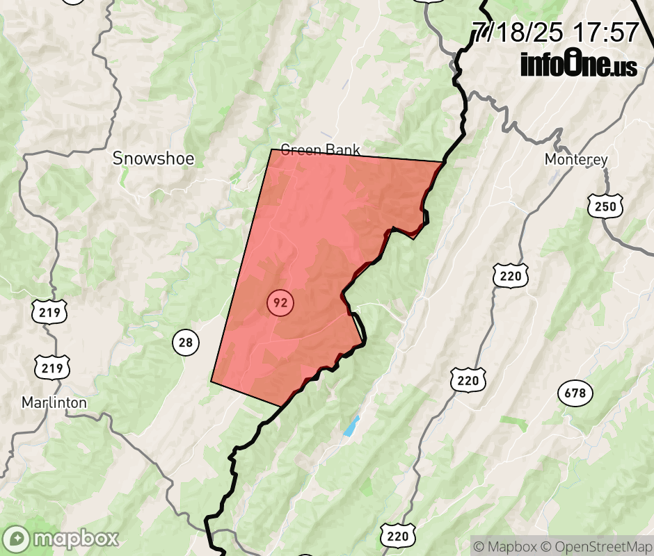 |
|||||||||
 Why aren't you using the InfoOne app? Why aren't you using the InfoOne app?
Stay abreast of information affecting your community! InfoOne tracks real-time information such as:
InfoOne currently supports over 100 communities in NC, VA and WV, and our coverage area is steadily growing. It's free! Install the InfoOne app today and see what you've been missing. |
|||||||||