|
|
Weather Alert |
| Jefferson County, WV | |||||||||
|
|
||||||||
|
Canceled 7/8/25 3:24 PM Severe Thunderstorm Warning issued July 8 at 3:08PM EDT until July 8 at 3:45PM EDT by NWS Baltimore MD/Washington DC SVRLWX The National Weather Service in Sterling Virginia has issued a * Severe Thunderstorm Warning for... Southeastern Washington County in north central Maryland... Southwestern Frederick County in north central Maryland... North central Loudoun County in northern Virginia... Northeastern Jefferson County in the Panhandle of West Virginia... * Until 345 PM EDT. * At 308 PM EDT, a severe thunderstorm was located over Harpers Ferry, or 7 miles southeast of Shepherdstown, moving east at 25 mph. HAZARD...60 mph wind gusts. SOURCE...Radar indicated. IMPACT...Damaging winds will cause some trees and large branches to fall. This could injure those outdoors, as well as damage homes and vehicles. Roadways may become blocked by downed trees. Localized power outages are possible. Unsecured light objects may become projectiles. * Locations impacted include... Frederick, Harry Grove Stadium, Ballenger Creek, Brunswick, Walkersville, Braddock Heights, Harpers Ferry, Clover Hill, Point Of Rocks, Discovery-Spring Garden, Linganore-Bartonsville, Adamstown, Jefferson, Lovettsville, Bolivar, Buckeystown, Rosemont, Rohrersville, Burkittsville, and Gapland. 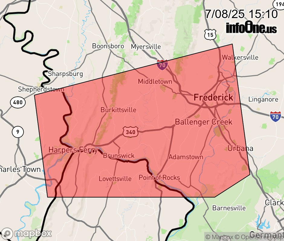 |
|||||||||
 Why aren't you using the InfoOne app? Why aren't you using the InfoOne app?
Stay abreast of information affecting your community! InfoOne tracks real-time information such as:
InfoOne currently supports over 100 communities in NC, VA and WV, and our coverage area is steadily growing. It's free! Install the InfoOne app today and see what you've been missing. |
|||||||||