|
|
Weather Alert |
| Pocahontas County, WV | |||||||||
|
|
||||||||
|
Canceled 6/18/26 8:45 AM Severe Thunderstorm Warning issued June 18 at 8:08AM EDT until June 18 at 8:45AM EDT by NWS Charleston WV SVRRLX The National Weather Service in Charleston West Virginia has issued a * Severe Thunderstorm Warning for... Southwestern Pocahontas County in northeastern West Virginia... Southeastern Nicholas County in southeastern West Virginia... Southwestern Webster County in northeastern West Virginia... East central Fayette County in southeastern West Virginia... * Until 845 AM EDT. * At 807 AM EDT, severe thunderstorms were located along a line extending from near Marlinton to Frankford, moving east at 70 mph. HAZARD...60 mph wind gusts. SOURCE...Radar indicated. IMPACT...Expect damage to roofs, siding, and trees. * Locations impacted include... Richwood, Babcock State Park, Camden-On-gauley, Camden On Gauley, Craigsville, Hillsboro, Buckeye, Calvin, Canvas, Cranberry Mountain Nature Center, Nettie, and Mount Nebo. This includes Route 19 between mile markers 31 and 37. 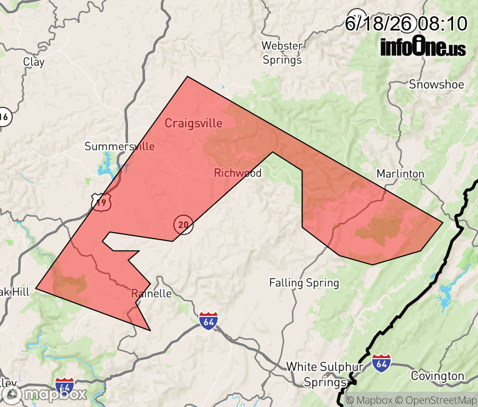 |
|||||||||
 Why aren't you using the InfoOne app? Why aren't you using the InfoOne app?
Stay abreast of information affecting your community! InfoOne tracks real-time information such as:
InfoOne currently supports over 100 communities in NC, VA and WV, and our coverage area is steadily growing. It's free! Install the InfoOne app today and see what you've been missing. |
|||||||||