|
|
Weather Alert |
| Nicholas County, WV | |||||||||
|
|
||||||||
|
Canceled 6/12/26 3:22 PM Severe Thunderstorm Warning issued June 12 at 2:58PM EDT until June 12 at 3:45PM EDT by NWS Charleston WV SVRRLX The National Weather Service in Charleston West Virginia has issued a * Severe Thunderstorm Warning for... Central Nicholas County in southeastern West Virginia... South central Clay County in north central West Virginia... Northeastern Fayette County in southeastern West Virginia... * Until 345 PM EDT. * At 258 PM EDT, a severe thunderstorm was located 9 miles northeast of Gauley Bridge, or 12 miles south of Clay, moving east at 30 mph. HAZARD...60 mph wind gusts and quarter size hail. SOURCE...Radar indicated. IMPACT...Hail damage to vehicles is expected. Expect wind damage to roofs, siding, and trees. * Locations impacted include... Summersville, Ansted, Calvin, Kesslers Cross Lanes, Bickmore, Canvas, Drennan, Muddlety, Swiss, Indore, and Mount Nebo. This includes Route 19 between mile markers 25 and 49. 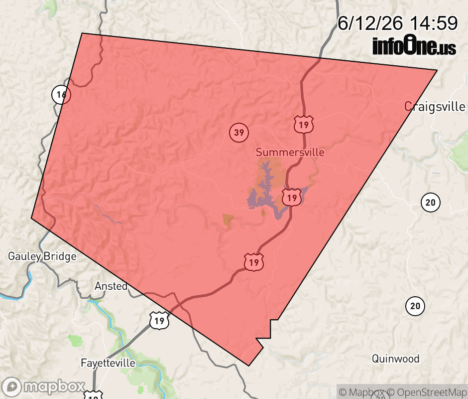 |
|||||||||
 Why aren't you using the InfoOne app? Why aren't you using the InfoOne app?
Stay abreast of information affecting your community! InfoOne tracks real-time information such as:
InfoOne currently supports over 100 communities in NC, VA and WV, and our coverage area is steadily growing. It's free! Install the InfoOne app today and see what you've been missing. |
|||||||||