|
|
Weather Alert |
| Guilford County, NC | |||||||||
|
|
||||||||
|
Canceled 7/15/25 6:47 PM Flash Flood Warning issued July 15 at 5:05PM EDT until July 15 at 7:30PM EDT by NWS Raleigh NC At 505 PM EDT, Doppler radar indicated thunderstorms producing heavy rain across the warned area. Between 2 and 4 inches of rain have fallen, with the heaviest rain noted near Monticello in northeastern Guilford County. Additional rainfall amounts of 1 to 2 inches are possible in the warned area. Flash flooding is ongoing or expected to begin shortly. HAZARD...Life threatening flash flooding. Thunderstorms producing flash flooding. SOURCE...Radar. IMPACT...Life threatening flash flooding of creeks and streams, urban areas, highways, streets and underpasses. Some locations that will experience flash flooding include... Burlington, Roxboro, Mebane, McLeansville, Concord, Carr, Bushy Fork, Schley, Hyco Lake, Hyco Marina, Union Ridge, Eno River State Park, Lake Cammack Park & Marina, Lake Burlington, Surl, Moriah, Glen Raven, Altamahaw-Ossipee, Altamahaw and Mayo Reservoir. 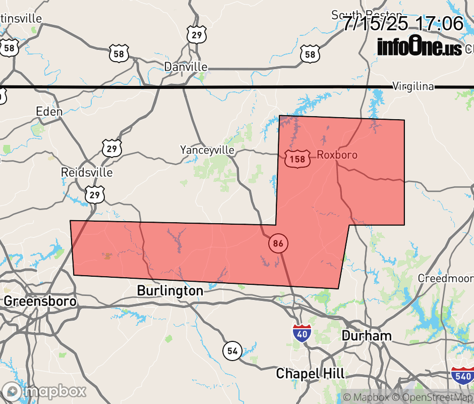 |
|||||||||
 Why aren't you using the InfoOne app? Why aren't you using the InfoOne app?
Stay abreast of information affecting your community! InfoOne tracks real-time information such as:
InfoOne currently supports over 100 communities in NC, VA and WV, and our coverage area is steadily growing. It's free! Install the InfoOne app today and see what you've been missing. |
|||||||||