|
|
Weather Alert |
| Athens County, OH | |||||||||
|
|
||||||||
|
Canceled 3/16/25 12:05 PM Severe Thunderstorm Warning issued March 16 at 11:39AM EDT until March 16 at 12:15PM EDT by NWS Charleston WV SVRRLX The National Weather Service in Charleston West Virginia has issued a * Severe Thunderstorm Warning for... Southeastern Perry County in southeastern Ohio... Northwestern Washington County in southeastern Ohio... Morgan County in southeastern Ohio... Central Athens County in southeastern Ohio... * Until 1215 PM EDT. * At 1139 AM EDT, severe thunderstorms were located along a line extending from near South Zanesville to 7 miles east of New Lexington to near Glouster to 6 miles southeast of Buchtel, moving east at 60 mph. HAZARD...60 mph wind gusts. SOURCE...Radar indicated. IMPACT...Expect damage to roofs, siding, and trees. * Locations impacted include... Chauncey, Stockport, Stroud Run State Park, Burr Oak State Park, McConnelsville, Rendville, Hackney, Beverly, Malta, Eagleport, Chesterhill, Lowell, Bristol, Fleming, Trimble, Amesville, Glouster, Jacksonville, Crooksville, and Bartlett. 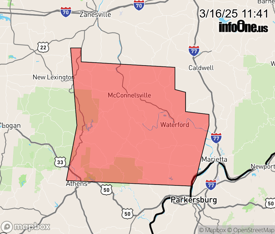 |
|||||||||
 Why aren't you using the InfoOne app? Why aren't you using the InfoOne app?
Stay abreast of information affecting your community! InfoOne tracks real-time information such as:
InfoOne currently supports over 100 communities in NC, VA and WV, and our coverage area is steadily growing. It's free! Install the InfoOne app today and see what you've been missing. |
|||||||||