|
|
Weather Alert |
| Forsyth County, NC | |||||||||
|
|
||||||||
|
Canceled 3/5/25 9:13 AM Severe Thunderstorm Warning issued March 5 at 9:00AM EST until March 5 at 9:45AM EST by NWS Raleigh NC At 900 AM EST, severe thunderstorms were located along a line extending from near Ellisboro to near Kernersville to near High Rock Lake, moving northeast at 35 mph. HAZARD...60 mph wind gusts and penny size hail. SOURCE...Radar indicated. IMPACT...Expect damage to roofs, siding, and trees. Locations impacted include... Greensboro, High Point, Trinity, Gordontown, Randleman Regional Reservior Marina, Stokesdale, Lexington, Kernersville, High Rock Lake, and Climax. 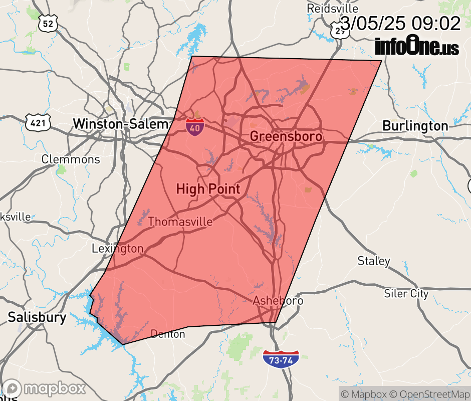 |
|||||||||
 Why aren't you using the InfoOne app? Why aren't you using the InfoOne app?
Stay abreast of information affecting your community! InfoOne tracks real-time information such as:
InfoOne currently supports over 100 communities in NC, VA and WV, and our coverage area is steadily growing. It's free! Install the InfoOne app today and see what you've been missing. |
|||||||||