
|
Weather Alert |
| Monroe County, OH | |||||||||
|
|
||||||||
|
Canceled 7/5/26 7:22 PM Flood Watch issued July 5 at 6:41PM EDT until July 5 at 10:00PM EDT by NWS Pittsburgh PA * WHAT... Flash flooding caused by excessive rainfall is possible. * WHERE... Portions of east central Ohio, including the following areas, Belmont, Carroll, Coshocton, Guernsey, Harrison, Jefferson OH, Monroe, Muskingum, Noble and Tuscarawas and the northern panhandle of West Virginia, including the following area, Marshall. * WHEN... Until 10 PM EDT this evening. * IMPACTS... Excessive runoff may result in flooding of rivers, creeks, streams, and other low-lying and flood-prone locations. * ADDITIONAL DETAILS... - Heavy rainfall from passing thunderstorms. - Some locations that may experience flooding include... Zanesville, Steubenville, New Philadelphia, Dover, Coshocton, Cambridge, Moundsville, Martins Ferry, Uhrichsville, St. Clairsville, Bellaire, Barnesville, Cadiz, Carrollton, Woodsfield and Caldwell. - http://www.weather.gov/safety/flood 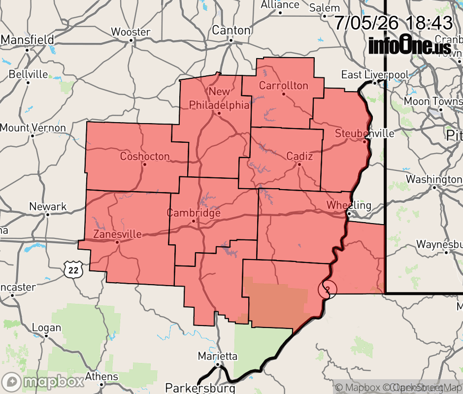 |
|||||||||
 Why aren't you using the InfoOne app? Why aren't you using the InfoOne app?
Stay abreast of information affecting your community! InfoOne tracks real-time information such as:
InfoOne currently supports over 100 communities in NC, VA and WV, and our coverage area is steadily growing. It's free! Install the InfoOne app today and see what you've been missing. |
|||||||||