|
|
Weather Alert |
| Portage County, OH | |||||||||
|
|
||||||||
|
Canceled 11/9/25 1:59 PM Winter Storm Watch issued November 9 at 10:05AM EST until November 11 at 10:00AM EST by NWS Cleveland OH * WHAT... Heavy lake effect snow possible. Total snow accumulations between 2 and 5 inches possible. * WHERE... Portions of north central and northeast Ohio. * WHEN... From 7 PM EST this evening through Tuesday morning. * IMPACTS... Visibilities may drop below 1/4 mile due to falling and blowing snow. Snowfall rates may exceed 1 to 2 inches per hour within well organized lake effect snow bands. The gusty winds and weight of snow on tree limbs may down power lines and could cause sporadic power outages. Travel could be difficult. The hazardous conditions could impact both the Monday morning and evening commutes as well as the Tuesday morning commute. * ADDITIONAL DETAILS... There may be an elevated risk for scattered power outages due to trees in the local area still having most of their leaves. The combination of leaves on trees and heavy wet snow may bring down large branches on to power lines during this early lake effect snow event. 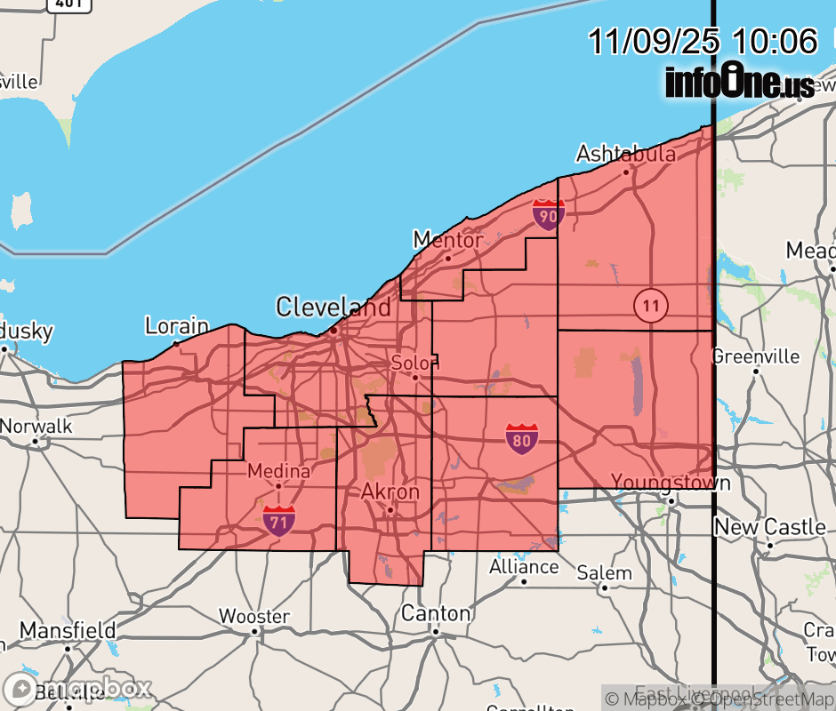 |
|||||||||
 Why aren't you using the InfoOne app? Why aren't you using the InfoOne app?
Stay abreast of information affecting your community! InfoOne tracks real-time information such as:
InfoOne currently supports over 100 communities in NC, VA and WV, and our coverage area is steadily growing. It's free! Install the InfoOne app today and see what you've been missing. |
|||||||||