|
|
Weather Alert |
| Wise County, VA | |||||||||
|
|
||||||||
|
Canceled 2/26/21 4:00 PM Hydrologic Outlook issued February 26 at 3:41AM EST by NWS Morristown TN Periods of rain, heavy at times, are expected across the area Today through early Monday morning. The heaviest and more widespread rainfall will likely fall across the entire region Sunday afternoon through early Monday morning when 2 to 3 inches are possible. Storm total rainfall through Monday morning may range up to 3 to 5 inches with locally heavier amounts. The rainfall Today through Saturday will help saturate the soils across the entire region. Therefore, any additional rainfall may lead to flash flooding concerns across East Tennessee, southwest Virginia, and southwest North Carolina beginning late Sunday. Flash flooding of roadways, low lying areas, small streams, and possibly mainstream rivers are possible. Mud slides are also a concern. There is still some uncertainty on the timing of periods of the heaviest rainfall and exact amounts over the next couple of days. However, confidence is increasing for the potential of heavy rainfall and flooding. We will continue to monitor this situation and will issue more information as the system approaches. Stay tuned to NOAA Weather Radio and other local media for further details, updates, and potential watches and warnings that may be issued. 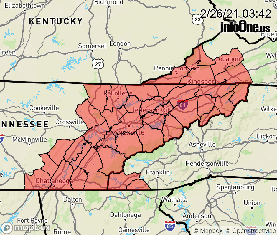 |
|||||||||
 Why aren't you using the InfoOne app? Why aren't you using the InfoOne app?
Stay abreast of information affecting your community! InfoOne tracks real-time information such as:
InfoOne currently supports over 100 communities in NC, VA and WV, and our coverage area is steadily growing. It's free! Install the InfoOne app today and see what you've been missing. |
|||||||||